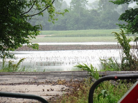
With heavy rains possible tonight in some areas, combined with additional releases of water from reservoirs upstream, the rivers in Wyandotte County potentially could rise.
At an Army Corps of Engineers news conference today, a National Weather Service meteorologist said the next 24 hours will be the worst for the amount of rain expected in the next seven days throughout the Missouri River basin.
Some areas could receive 2 to 2.5 inches of rain tonight, while Wyandotte County’s forecast predicts a half to three-quarters of an inch of rain tonight.
A severe storm is poised to hit the Kansas City area this afternoon, and Wyandotte County currently is under a tornado watch.
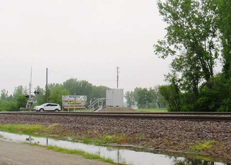
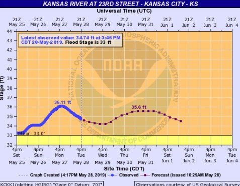
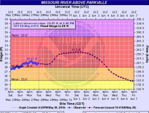
Flooding is now at the moderate stage at the Missouri River at Parkville, which covers the Wyandotte County area. The gauge is at I-435 at the Missouri River. The Kansas River is in minor flood stage at Kansas Avenue and the state line.
Corps of Engineers officials said they had run out of automatic sandbag machines, with all issued to communities in need. As of last week, there were 680,000 sandbags issued by the Kansas City district of the Corps of Engineers.
Water releases from the Gavins Point dam in South Dakota were increased from 60,000 to 65,000 cubic feet per inch at noon today, officials said. Another increase to 70,000 cfs is planned on Wednesday.
The reservoirs upstream on the Missouri River are full and need to release water, according to officials. Because there are heavy rains predicted to the north, it’s possible that releases will need to be increased again later this week from the Gavins Point dam, according to officials.
In the meantime, Kansas reservoirs are seeing the same situation, as officials are trying to manage inflows as they occur, according to officials.
Perry was 100 percent flood control occupied today, according to officials.
About 5,000 cfs of water was released from Perry on Sunday, officials said.
There are plans to begin releases on Wednesday from Tuttle Creek, of about 15,000 to 20,000 cfs, which will flow into the Kansas River.
Corps officials said if the water levels exceed the flood control pool at the reservoirs, if they do not release water, they will not be able to manage flows and will be more vulnerable to rainfall as it occurs.
The river levels have been falling for the last 24 hours, and are expected to start rising again on Wednesday, when the water releases reach Kansas City, according to officials.
The Corps of Engineers knows that the water releases will create a higher stage downstream and there will be some flooding, but it will not be as high as the March flooding this spring, according to officials. Officials said the federal levees are performing very well, although there is always concern about the entire reach of the river.
For more weather information, visit www.weather.gov.
For information on river flooding, see https://water.weather.gov/ahps2/index.php?wfo=eax