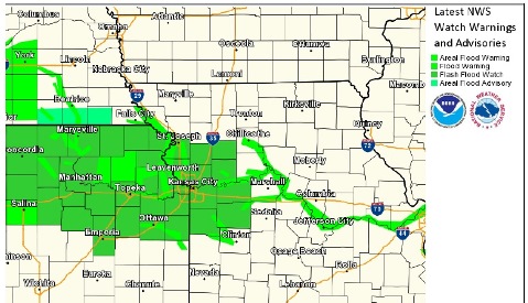
A flood warning was in effect for Kansas City, Kan., and rain moved through the area this morning.
Tonight, there could be more rain after midnight, with a 20 percent chance of precipitation, according to the National Weather Service.
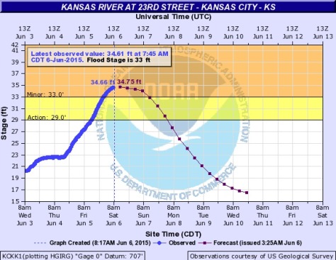
The flood warning is in effect for the Kansas River at 23rd Street in Kansas City, Kan., and continues now through 12:27 p.m. Monday, June 8, according to the weather service. Several other flood warnings are in effect in the region.
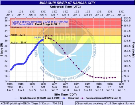
The Kansas River at 23rd Street was at 34.66 feet at 7:45 a.m. Saturday, according to a hydrology chart. It was above the flood stage of 33 feet and minor flooding was occurring.
The river will continue rising to near 34.8 feet by this afternoon, the weather service said. The river will fall below flood stage early Sunday afternoon.
At 33 feet, undeveloped woodland along the river and outside of levee protection is flooded, according to the weather service. No flooding of areas behind the levees is expected.
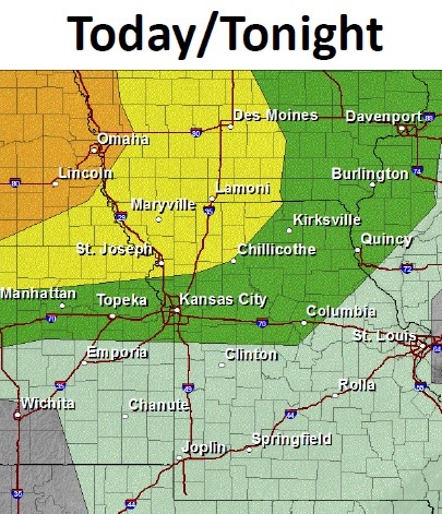
The storm this morning included wind and lightning. Today’s high will be about 83 degrees, the weather service said.
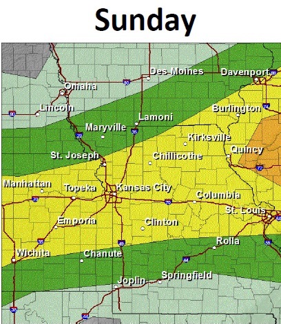
Sunday’s forecast is a 50 percent chance of showers and thunderstorms after 7 a.m. Sunday’s high will be near 87.
Sunday night, expect a 60 percent chance of storms. The low will be 68.
An additional thunderstorm complex is anticipated to develop over portions of Nebraska and Iowa this afternoon or evening, with some of this activity moving into portions of northeast Kansas and northern Missouri tonight. Some of these storms may be strong to severe. More thunderstorms are expected as a front moves through on Sunday, bringing with it the potential for severe weather and heavy rainfall.
The weather service advised drivers not to drive through flowing water. Nearly half of all flood fatalities are vehicle related. As little as 6 inches of water may cause you to lose control of your vehicle. Two feet of water will carry most vehicles away.
For more weather information, visit www.weather.gov/kc/.