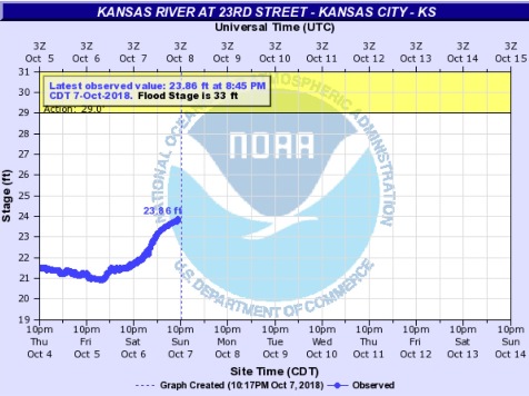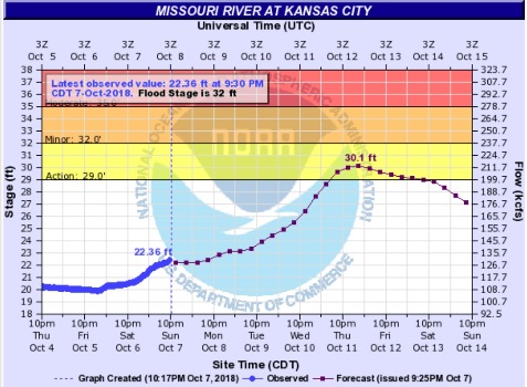
A flash flood watch is in effect for Wyandotte County and surrounding counties through 7 a.m. Monday morning, according to the National Weather Service.
Moderate to heavy rainfall is expected to produce 1 to 3 inches of rain over an area that has saturated soils, according to the weather service.
These storms could cause flooding along area creeks, streams and rivers, low water crossings and other flood-prone areas in the far northern part of the region. Flash flooding over more urban areas is also possible.
Motorists are advised to avoid areas which are flooding, and do not try to cross flooded streets.