Flash flood watch continues in Wyandotte County

Wyandotte County was in a marginal risk area for severe weather, according to a chart from the National Weather Service. (National Weather Service graphic)

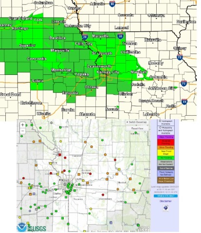
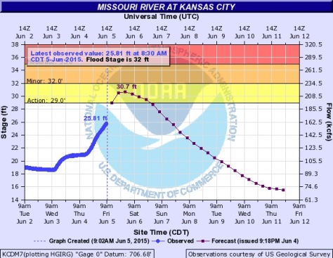
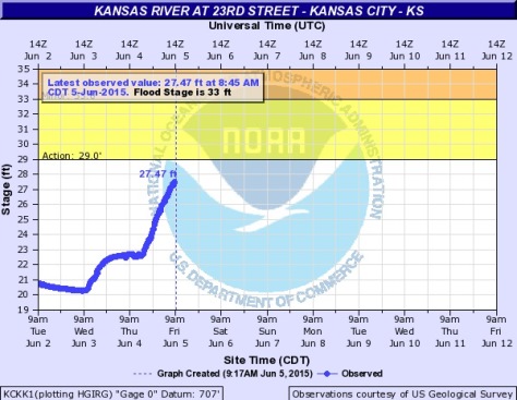
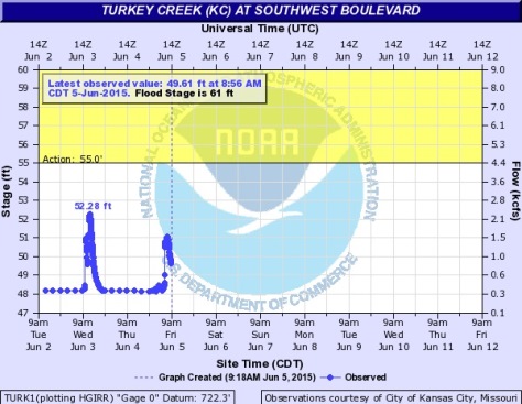
A flash flood watch continues until 4 p.m. June 6 as heavy rain moved through Wyandotte County this morning.

Showers and storms are expected to weaken by mid to late morning. Another round of thunderstorms is expected to materialize across the region late this afternoon into the evening, according to the National Weather Service.

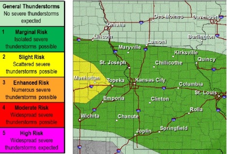
A few strong storms may be possible, with gusty winds, small hail, and very heavy rainfall the primary concern, the weather service said.

Wyandotte County has a 30 percent chance of showers and storms today, according to the National Weather Service. Flooding is possible because the ground is already saturated.

Today’s high will be near 81. Tonight’s low will be around 67, according to the weather service.

Saturday, there will be a 20 percent chance of showers and thunderstorms before 1 p.m., according to the weather service. The high will be 83.

Sunday, there is a 50 percent chance of showers and thunderstorms, with a high near 87, according to the weather service.

Sunday night’s low will be around 67, and there is a 50 percenet chance of showers and thunderstorms, according to the weather service.

Monday, look for a high near 82.

A 30 percent chance of showers and thunderstorms returns on Tuesday, the weather service said.

Many area rivers remain in flood stage throughout the region, according to the National Weather Service. In Wyandotte County, the Missouri and Kansas rivers are still under flood stage. (National Weather Service graphic)

A NOAA and USGS hydrology chart shows the possibility of the Missouri River at Kansas City going into the "action stage" on Friday evening. That is still below the flood stage of 32 feet. (NOAA chart)
A NOAA and USGS hydrology chart shows the possibility of the Missouri River at Kansas City going into the “action stage” on Friday evening. That is still below the flood stage of 32 feet. (NOAA chart)

A NOAA and USGS chart showed the Kansas River at Kansas City, Kan., at 27.47 feet on Friday morning. The action stage is 29 feet and flood stage is 33 feet. (NOAA chart)

Turkey Creek at Southwest Boulevard was showing some spikes in its levels. Levels reached about 51 feet on Friday morning, with the action stage at 55 feet, and flood stage at 61 feet. (NOAA chart)