A flash flood warning has been extended for Wyandotte County and surrounding areas including southeastern Leavenworth County, Johnson County, Kan., Clay County, southern Ray County, eastern Platte County and Jackson County.
At 8:07 a.m. Thursday, radar indicated heavy rain across the warning area. Three to 7 inches of rain have fallen, and flash flooding was already occurring, according to the weather service.
Locations that will experience flooding include Kansas City, Kansas, as well as some surrounding areas.
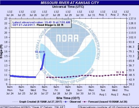
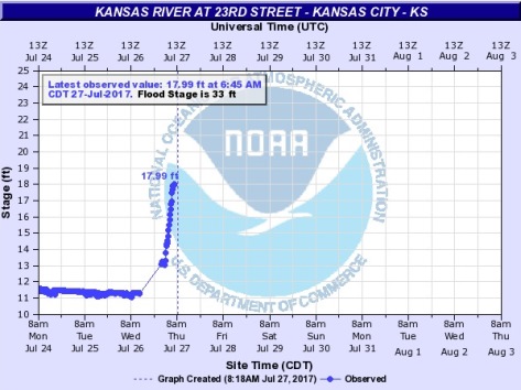
In neighboring communities, extensive flooding has occurred near Indian Creek with water over the road at 103rd and Wornall Road in Kansas City, Mo. Multiple water rescues have taken place there. Indian Creek has crested and is starting to fall, according to the weather service.
In other neighboring communities, the Blue River also has experienced minor flooding and is starting to crest. Tomahawk Creek reached record flooding overnight but has crested and is starting to fall, according to the weather service.
Residents are asked to turn around and go back when they encounter flooded roadways. Most deaths occur in vehicles, according to the weather service. Residents may report flooding to local law enforcement agencies, the weather service said.