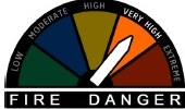
The biggest concern during the next few days will be related to fire weather, the National Weather Service said.
With gusty winds anticipated today and again on Saturday, combining with lowered relative humidity values and dry fuels, this sets the stage for fires to spread rapidly, according to the weather service. Burning is highly discouraged.
The next chance for precipitation holds off until early next week, the weather service said.
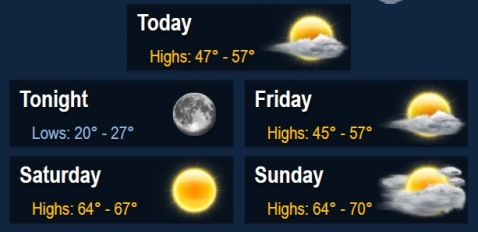
Today, it will be sunny with a high near 54, and a south southwest wind of 7 to 17 mph becoming north northwest in the afternoon, according to the weather service. Winds may gust as high as 26 mph.
Tonight, the low will be around 26 with mostly clear skies. A north northwest wind of 6 to 11 mph will become light and variable after midnight, the weather service said.
Friday’s forecast is sunny with a high near 55, according to the weather service. A light east southeast wind will become south 11 to 16 mph in the morning. Winds may gust as high as 24 mph.
Friday night, it will be mostly clear with a low of 44, the weather service said. A south wind of 13 to 17 mph will gust as high as 25 mph.
Saturday, the high will be near 66 with sunny skies, according to the weather service. It will be breezy, with a south southwest wind of 16 to 23 mph, gusting as high as 31 mph.
Saturday night, expect a low of 51 with partly cloudy skies, the weather service said.
Sunday, it will be 66 with partly sunny skies, according to the weather service.
Sunday night’s low will be around 56 with mostly cloudy skies, the weather service said.
Monday, the high will be near 71 with partly sunny skies, according to the weather service. It will be breezy.
Monday night, there is a 30 percent chance of showers and thunderstorms, with a low of 43, the weather service said.