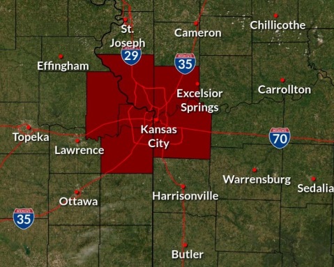
Wyandotte County is under an excessive heat watch from 1 p.m. Friday, July 23, until 7 p.m. Wednesday, July 28, according to the National Weather Service.
Dangerous heat will build into the area this weekend and persist through late next week, according to the weather service. The heat will peak on Sunday afternoon.
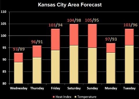
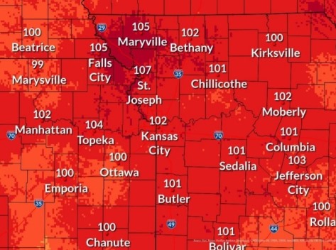
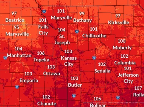
The heat index could range from 100 to 105 starting Friday, according to the weather service.
There is a chance for clouds and rain on Monday, when the heat index could drop to 97, the weather service said.
Then, heat will increase Tuesday through next week, according to the weather service.
Potentially, it will be even hotter next week, with the heat index possibly ranging from 105 to 110, the weather service said.
Today, there will be quiet weather with near normal temperatures, according to the weather service.
It will be mostly sunny, with a high near 89 and a light and variable wind, the weather service said.
Tonight, it will be partly cloudy, with a low of 69 and a south wind around 5 mph, becoming calm in the evening, according to the weather service.
Thursday, it will be sunny, with a high near 91 and a calm wind becoming south southwest 5 to 8 mph in the morning, the weather service said.
Thursday night, it will be mostly clear, with a low of 72 and a south wind of 7 mph, according to the weather service.
Friday, it will be sunny, with a high near 94 and a south southwest wind of 6 to 8 mph, the weather service said.
Friday night, it will be mostly clear, with a low of 75, according to the weather service.
Saturday, it will be sunny, with a high near 96, the weather service said.
Saturday night, it will be mostly clear, with a low of 75, according to the weather service.
Sunday, there is a 30 percent chance of showers after 1 p.m., with a high near 94, the weather service said.
Sunday night, there is a 30 percent chance of showers after 1 a.m., with a low of 74, according to the weather service.
Monday, there is a 30 percent chance of showers, with a high near 93,the weather service said.
Monday night, it will be partly cloudy, with a low of 74, according to the weather service.
Tuesday, it will be sunny, with a high near 94, the weather service said.
The Unified Government has a list of cooling centers online at