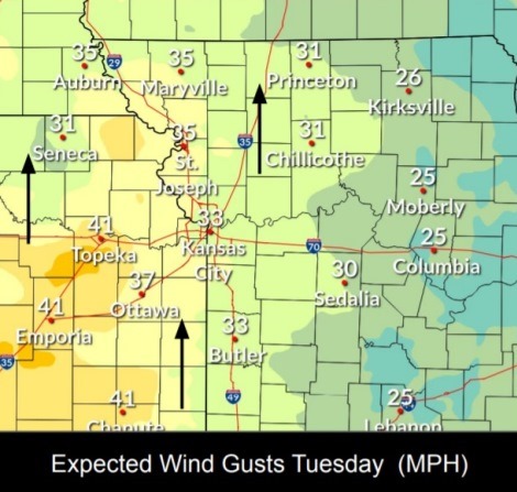
Wind gusts today could be over 30 mph. (National Weather Service graphic)
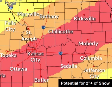
Wyandotte County has a high potential for over 2 inches of snow on Thursday. (National Weather Service graphic)

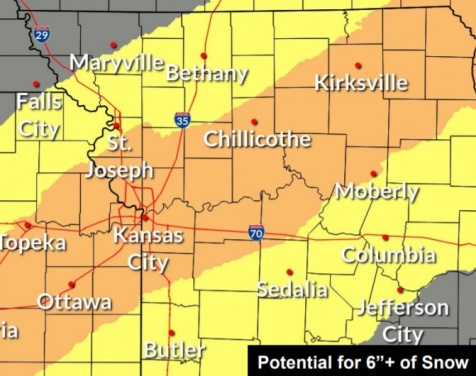

There is a moderate chance of six inches of snow on Thursday. (National Weather Service graphic)
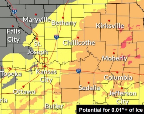
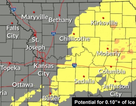
There is a low chance for one-one hundredth of an inch of ice on Wednesday and Thursday in Wyandotte County. (National Weather Service graphic)


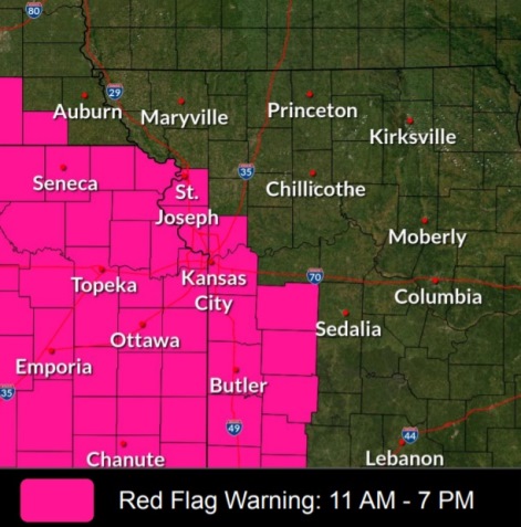
Wyandotte County is under a red flag warning from 11 a.m. to 7 p.m. Tuesday, Feb. 15, according to the National Weather Service.
The red flag warning is a caution that dangerous fire weather may develop Tuesday afternoon, with high winds, dry conditions and low humidity.
Winds could gust as high as 34 mph today, according to the weather service. Outdoor burning is not recommended today, the weather service said.
Also in the forecast is a winter storm on Thursday. Rain is likely on Wednesday, with rain changing to a mix Wednesday night and eventually to snow on Thursday, the weather service said. Freezing rain could start around 2 a.m. Thursday, according to the current forecast, which is subject to change.
From 2 to 4 inches of snow is possible on Thursday, the weather service said. There is still a certain amount of uncertainty as to the track, timing and amounts of snow, however.
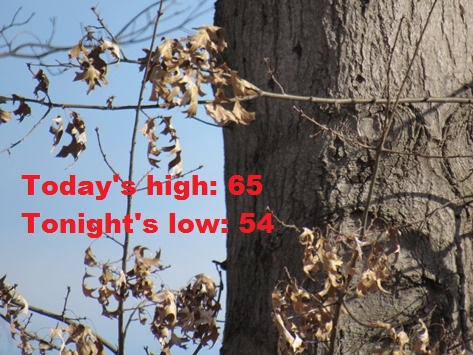
Today, there will be increasing clouds, with a high near 65 and a south wind of 10 to 15 mph increasing to 17 to 22 in the afternoon, the weather service said. Winds may gust up to 34 mph.
Tonight, it will be mostly cloudy, with a low of 54 and a south wind of 17 to 22 mph, gusting as high as 33 mph, according to the weather service.
Wednesday, there is a 60 percent chance of rain, mainly after noon, the weather service said. It will be mostly cloudy, with a high near 58. A south southwest wind of 11 to 16 mph will become north in the afternoon. Winds could gust as high as 31 mph. Less than a tenth of an inch of rain is possible.
Wednesday night, there is an 80 percent chance of rain, possibly mixed with freezing rain before 3 a.m., then snow, possibly mixed with freezing rain and sleet between 3 a.m. and 4 a.m., followed by snow, mixed with freezing rain after 4 a.m., according to the weather service. The low will be aroun 21 with a north northeast wind of 10 to 16 mph, gusting to 25 mph. Little or no ice accumulation is expected. New snow and sleet accumulation of less than a half-inch is possible.
Thursday, there is a 70 percent chance of snow, possibly mixed with freezing rain, and becoming all snow after 7 a.m., the weather service said. The snow could be heavy at times. Patchy blowing snow is possible between 7 a.m. and noon. It will be cloudy, then gradually becoming mostly sunny, with a high near 29. A north wind of 11 to 18 mph will gust as high as 32 mph. From 2 to 4 inches of snow is possible.
Thursday night, it will be mostly clear, with a low of 8, according to the weather service.
Friday, it will be sunny, with a high near 43, the weather service said.
Friday night, it will be mostly clear, with a low of 26, according to the weather service.
Saturday, it will be sunny, with a high near 48, the weather service said.
Saturday night, it will be mostly clear, with a low of 35, according to the weather service.
Sunday, it will be sunny, with a high near 56, the weather service said.
Sunday night, it will be mostly clear, with a low of 41, according to the weather service.
On Monday, Presidents Day, it will be mostly sunny, with a high near 64, the weather service said.
See updated weather reports at www.weather.gov.