Wyandotte County will see cooler temperatures on Friday, with a high in the 60s, before the weather warms up on Saturday, when it will be in the 70s, according to the National Weather Service.
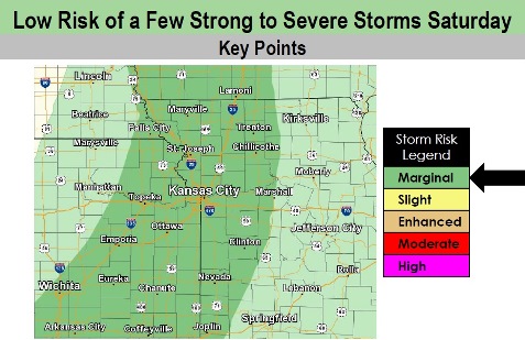
Rain and thunderstorm chances increase Saturday as a cold front pushes in from the northwest through the mid to late afternoon, according to the weather service.
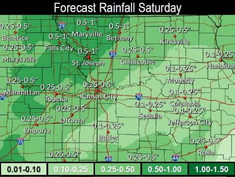
Rain amounts could total a quarter-inch to three-quarters of an inch, the weather service said.
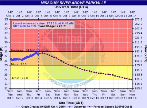
Wyandotte County remains under a flood warning for the Missouri River at Parkville, where the gauge is on I-435 over the Missouri River between Wyandotte and Platte counties. The river is currently in minor flood stage. The river is expected to rise to almost 27.7 feet by Friday evening, where 25 feet is flood stage. The river is forecast to fall below flood stage Monday evening, according to the weather service.
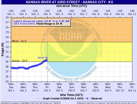
The Kansas River at 23rd Street, where the gauge is near Kansas Avenue and the state line, is currently in action stage, and below minor flood stage.
Residents are warned not to drive through flowing water, but to turn around and find another route.
Today, there is a 20 percent chance of sprinkles before 3 p.m., then a slight chance of showers between 3 p.m. and 5 p.m., then a chance of sprinkles with a slight chance of showers after 5 p.m., the weather service said. The high will be near 63 with an east wind of 3 to 6 mph.
Tonight, there is a 30 percent chance of sprinkles before 8 p.m., then a chance of showers after 4 a.m., according to the weather service. The low will be around 57 with a calm wind becoming southeast around 6 mph after midnight. Less than a tenth of an inch of rain is expected.
Saturday, there is a 90 percent chance of showers and thunderstorms likely before 8 a.m., then showers and possibly a thunderstorm between 8 a.m. and 1 p.m., then a chance of showers and thunderstorms after 1 p.m., the weather service said. The high will be near 74 with a south wind of 6 to 13 mph becoming west northwest in the afternoon. Winds may gust as high as 26 mph. Between a quarter and half-inch of rain is possible.
Saturday night, it will be mostly clear, with a low of 48 and a light northwest wind, according to the weather service.
Sunday, there will be increasing clouds, with a high near 67 and a calm wind, the weather service said.
Sunday night, it will be mostly clear, with a low of 46, according to the weather service.
Monday, it will be sunny, with a high near 69, the weather service said.
Monday night, it will be clear with a low of 47, according to the weather service.
Tuesday, it will be sunny with a high near 70, the weather service said.
Tuesday night, it will be partly cloudy, with a low of 52, according to the weather service.
Wednesday, it will be partly sunny, with a high near 71, the weather service said.
Wednesday night, there is a 30 percent chance of showers, with a low of 53, according to the weather service.
Thursday, there is a 30 percent chance of showers, with a high near 65, the weather service said.