Temperatures were 15 degrees at 8 a.m. Friday, with a wind chill reading of 6 degrees, and cold weather predicted through the weekend, according to the National Weather Service.
A little snow may accumulate on Sunday, the weather service said. Less than an inch is expected.
Additional snow showers could be possible on Monday night and Tuesday, according to the weather service.
The weather service noted that today is the anniversary of the Feb. 1-2, 2011, blizzard and record snowfall.
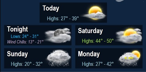
Today’s high will be near 37 with mostly sunny skies, the weather service said. A light east southeast wind will become south 5 to 9 mph in the morning, with winds gusting as high as 18 mph.
Tonight, the low will be around 30, with mostly cloudy skies, and a south southwest wind of 8 to 13 mph, gusting to 24 mph, according to the weather service.
Saturday, the high will be near 49, with partly sunny skies, the weather service said. A south southwest wind of 11 to 17 mph will gust as high as 26 mph.
Saturday night, the low will be 24 with mostly cloudy skies and a south southwest wind of 5 to 9 mph becoming north after midnight, according to the weather service.
Sunday, there is a 40 percent chance of snow, with a high near 27, the weather service said. A north wind of 7 to 13 mph will gust as high as 22 mph.
Sunday night, the low will be around 12 with mostly clear skies, according to the weather service.
Monday, the high will be near 36 with partly sunny skies, the weather service said.
Monday night, there is a 30 percent chance of snow after midnight, with a low of 23, according to the weather service.
Tuesday, there is a 40 percent chance of snow with a high near 31, the weather service said.
Tuesday night, the low will be 17 with mostly cloudy skies, according to the weather service.
Wednesday, the high will be near 34 with mostly sunny skies, the weather service said.