Cold temperatures continue Thursday, when the high will be 28, according to the National Weather Service.
Single-digit wind chill values continued early Thursday morning and are expected Friday morning, as well. The wind chill climbed to 10 degrees at 8 a.m. Thursday.
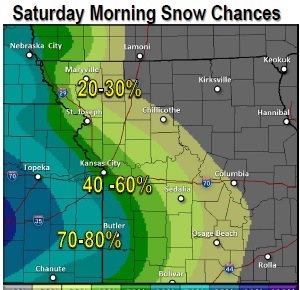
The first snow of the season is predicted to fall on Saturday, mostly after noon.
There will be sunny skies and a northwest wind of 9 to 13 mph Thursday.
Thursday night’s low will be around 13.
Friday, look for mostly sunny skies, with a high near 32.
Friday night, the low will be around 22.
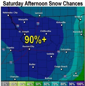
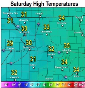
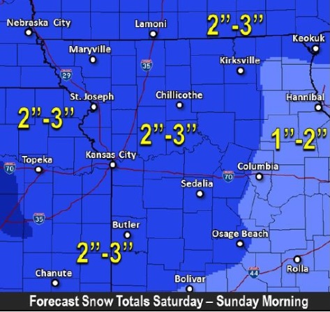
Saturday, there is an 80 percent chance of snow, mainly after noon. From 1 to 3 inches of snow are possible. The high will be near 30. The south southeast wind will be 5 to 9 mph.
Saturday night, there is a 50 percent chance of snow, with a low of 19.
Sunday, look for partly sunny skies and a high near 28. The low on Sunday night will be around 15.
On Monday, there will be mostly sunny skies and the high will be near 27; the low on Monday night will be around 8.
Tuesday’s forecast is mostly clear with a high near 27, and Tuesday night, the low will be around 16.
On Wednesday, there will be sunny skies with a high near 37.