There will be a chance of showers and thunderstorms this afternoon and evening in Wyandotte County, according to the National Weather Service.
Warm temperatures with muggy conditions are expected through the week, according to the weather service.
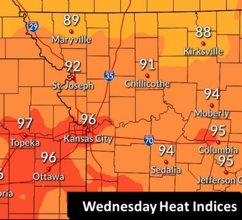
The daily heat index could reach between 90 and 95 each day this week, the weather service said.
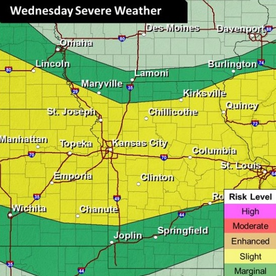
There is some uncertainty regarding the timing and placement of the mid to late week thunderstorms, the weather service said. The storms are possible Wednesday through Friday.
Strong storms are expected to form a line today, generally south of Highway 36, which is near the northern border of Kansas and near St. Joseph, Missouri, according to the weather service. These storms could form after 3 p.m. and could last into the late evening.
Another round of thunderstorms is possible overnight tonight, around or after 1 a.m., the weather service said.
The heat index on Wednesday will rise above 85 degrees around 11 a.m. and will stay above 85 through 9 p.m., reaching a high between 90 and 95 this afternoon, according to the weather service.
Today, there is a 30 percent chance of showers and thunderstorms, mainly after 3 p.m., the weather service said. The high will be near 90 with a heat index as high as 95. A south wind of 6 to 8 mph will become west northwest in the afternoon.
Tonight, there is a 70 percent chance of showers and thunderstorms likely, mainly after 1 a.m., according to the weather service. The low will be around 69 with a light and variable wind becoming south southwest 5 to 10 mph after midnight. Between a quarter and half-inch of rain is possible.
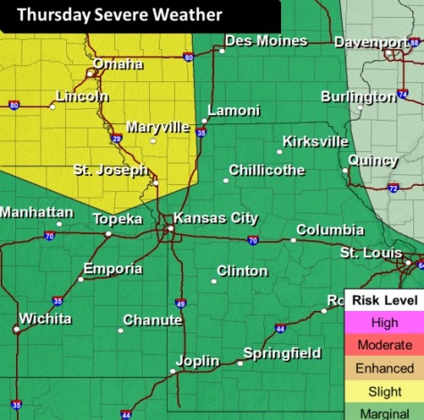
Thursday, there is a 20 percent chance of showers and thunderstorms, with a high near 89, the weather service said. A northeast wind of 5 to 9 mph will become light and variable in the afternoon.
Thursday night, there is a 20 percent chance of showers and thunderstorms, with a low of 71, according to the weather service. A south southeast wind will be 3 to 5 mph.
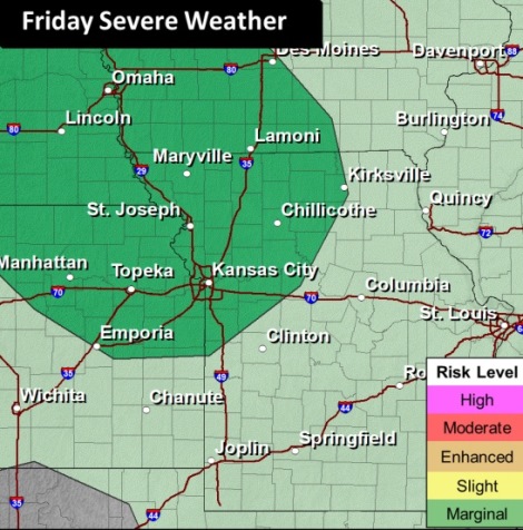
Friday, there is a 30 percent chance of showers and thunderstorms after 1 p.m., the weather service said. The low will be around 71, with a south southeast wind of 3 to 5 mph.
Friday night, there is a 20 percent chance of showers and thunderstorms before 1 a.m., with a low of 72, according to the weather service.
Saturday, it will be mostly sunny, with a high near 92, the weather service said.
Saturday night, it will be partly cloudy, with a low of 73, according to the weather service.
Sunday, it will be mostly sunny, with a high near 91, the weather service said.
Sunday night, it will be mostly clear, with a low of 73, according to the weather service.
Monday, it will be mostly sunny, with a high near 88, the weather service said.
Monday night, it will be partly cloudy, with a low of 71, according to the weather service.
Tuesday, there is a 30 percent chance of showers and thunderstorms, with a high near 84, the weather service said.