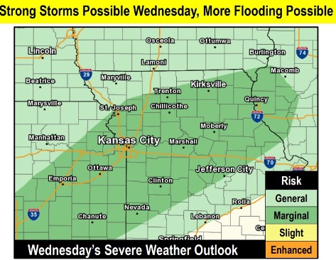
Today’s forecast contains a 60 percent chance of showers and thunderstorms, mainly after 5 p.m., according to the National Weather Service.
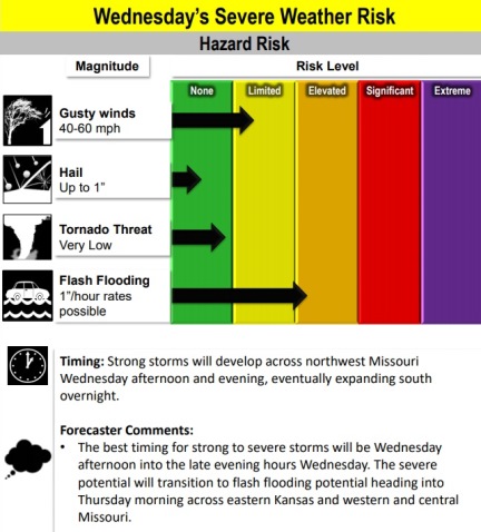
There is a low chance of severe weather including frequent lightning, large hail and strong wind gusts, the weather service said.
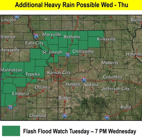
Flash flooding also is a concern.
Isolated strong wind gusts of up to 50 mph to 60 mph, in addition to isolated hail up to 1 inch in diameter, is possible Wednesday afternoon and evening, according to the weather service.
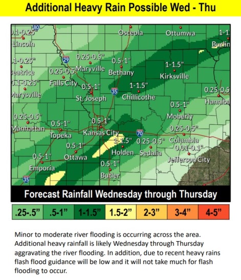
Flooding also will continue along local streams.
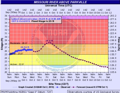
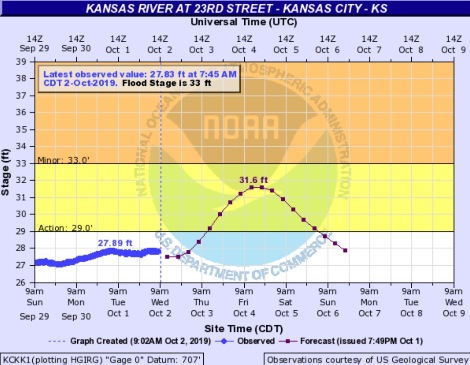
The Missouri River at Parkville is currently in minor flood stage and could rise to moderate flood stage in the next few days, according to hydrology charts. This gauge is on I-435 between Wyandotte County and Platte County, and it affects the Wolcott area.
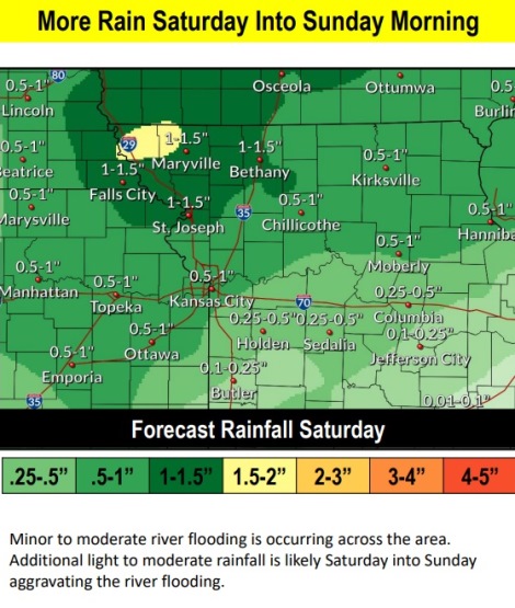
Additional heavy rainfall is likely Wednesday through Thursday, aggravating the river flooding, the weather service said. In addition, because of recent heavy rains flash flood guidance will be low and it will not take much for flash flooding to occur.
Today, there is a 60 percent chance of showers and thunderstorms likely, mainly after 5 p.m., the weather service said. The high will be near 79 with a light and variable wind becoming south southwest 5 to 8 mph in the afternoon. Between a quarter and half-inch of rain is possible.
Tonight, there is an 80 percent chance of showers and thunderstorms, mainly before 10 p.m., according to the weather service. The low will be around 52 with a north northwest wind of 5 to 11 mph, gusting as high as 18 mph. Between a quarter and half-inch of rain is possible.
Thursday, it will be cloudy, changing gradually to mostly sunny, with a high near 65, the weather service said. A north northwest wind will be at 11 mph, gusting to 20 mph.
Thursday night, it will be mostly cloudy, with a low of 51 and a light north wind, according to the weather service.
Friday, it will be mostly cloudy, with a high near 65 and an east wind of 3 to 6 mph, the weather service said.
Friday night, there will be a 20 percent chance of showers and thunderstorms after 1 a.m., according to the weather service. The low will be around 58.
Saturday, there is a 60 percent chance of showers and thunderstorms, mostly before 1 p.m., the weather service said. The high will be near 75.
Saturday night, the low will be around 49, according to the weather service, with mostly clear skies.
Sunday, it will be mostly sunny, with a high near 69, the weather service said.
Sunday night, it will be partly cloudy, with a low of 48, according to the weather service.
Monday, it will be sunny, with a high near 68, the weather service said.
Monday night, it will be mostly clear, with a low of 46, according to the weather service.
Tuesday, it will be sunny, with a high near 69, the weather service said.