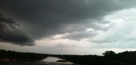
Storm clouds moved into Wyandotte County this evening. This view is looking east at the Kansas River near Edwardsville.
A severe thunderstorm warning is in effect until 8:15 p.m. June 22 for Wyandotte County, according to the National Weather Service.
The storm was moving southeast at 25 mph. Wyandotte County is in its path.
The weather service advises resident to move to an interior room of the lowest floor of a building.
Today’s weather will be sunny with a high of 91, according to the National Weather Service.
Saturday, a 20 percent chance of showers is in the forecast. The day will be mostly sunny with a high of 91. The heat index Saturday may be as high as 96.
On Sunday, there will be a 30 percent chance of showers and thunderstorms. The high will be near 89.
More showers are in the forecast Sunday night, when a quarter to a half of an inch of rain is possible.
Monday will see a 70 percent chance of showers and thunderstorms, with a high near 82.
With additional rain, there is the possibility of flooding along the Missouri River next week.
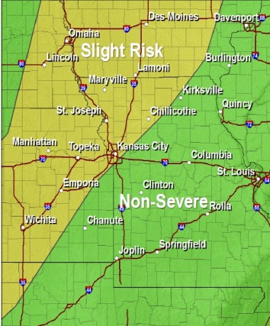
Slight chance of severe storms. (National Weather Service graphic)
Showers and scattered thunderstorms are possible after 4 p.m. Thursday, according to the National Weather Service.
There is a 60 percent chance of rain. The chance of severe storms is slight. While shear is very weak, strong instability will develop over the area during the heat of the day, and with plenty of moisture in place, there is the potential for large hail and damaging winds with stronger storms, the weather service said.
Today’s temperatures should reach a high near 84. The south wind will be 9 to 18 mph, with gusts as high as 26 mph.
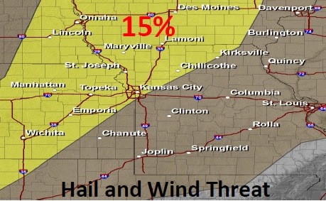
The weather service said there is a chance a few isolated storms could become severe with large hail and damaging winds the main threat, north of a Kirksville, Mo., to Kansas City line.
Tonight, the chance of showers and thunderstorms continues, mainly before 10 p.m. The area could receive between a quarter and half-inch of rain. Hail and wind threat. (National Weather Service graphic)