Snow on its way to Wyandotte County

National Weather Service graphic

No snow had fallen in Wyandotte County by 10 a.m. Saturday, but a radar map from the National Weather Service showed snow was on the way.

A snow storm was already on the map at 10 a.m. for Topeka, Leavenworth, St. Joseph, Mo., and Ottawa, according to the radar map.

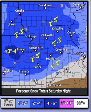
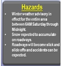
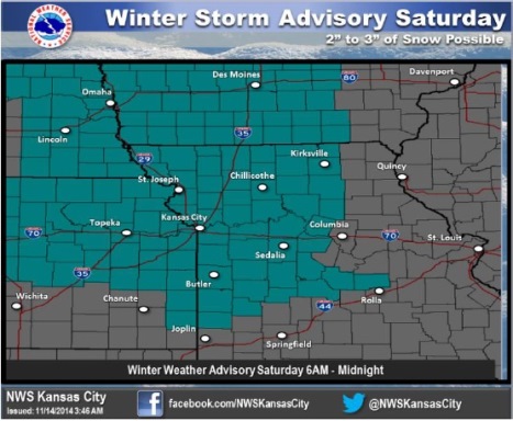
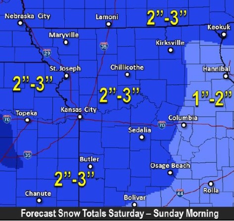
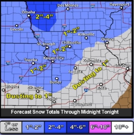
The area is under a winter weather advisory through midnight tonight. One to two inches of snow is expected today.

Snow, sleet or freezing rain are expected to cause travel difficulties, the weather service said. Residents should be prepared for slipper roads and limited visibility, and use caution while driving.

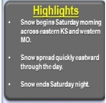
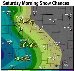
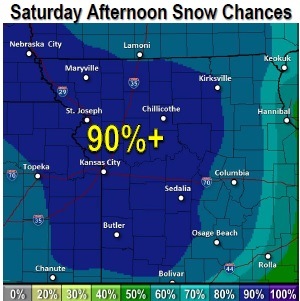
Snow is expected to start falling sometime in the mid-morning to late morning on Saturday. Snow could continue to fall as late as midnight tonight.

Snow may accumulate on roadways, making travel difficult, the weather service said.

For weather updates, visit www.weather.gov.

With snow on the way Saturday, winter weather advisory issued for area

National Weather Service graphic

Snow is expected to accumulate this weekend, according to the National Weather Service.

The weather service has issued a winter weather advisory Saturday for this region, including Wyandotte County.

Snow will overspread the area after daybreak Saturday, according to the weather service, with snow gradually tapering off by late afternoon and early evening. Accumulations of 2 to 4 inches are expected for much of the area before snow comes to an end Saturday evening.

The winter weather advisory is in effect from 6 a.m. Saturday to midnight Saturday.

The weather service said accumulating snow and reduced visibility will result in hazardous travel across the region through much of the area. Motorists should be prepared for slippery roads and limited visibility. There will be dangerous road conditions.

Friday’s weather will be mostly sunny with a high near 31. The winds are calm in the morning, and may grow to 5 mph in the afternoon. Tonight, the skies will be partly cloudy with a low of 20.

Saturday’s high will be near 31, with a 90 percent chance of snow.

Saturday night, there is a chance of flurries before midnight. The low will be around 15. Winds will be 6 to 11 mph after midnight.

National Weather Service graphic

National Weather Service graphic
Sunday’s temperatures will reach a high of 27, with northwest wind of 7 to 10 mph.

Sunday night, it will be mostly clear, with a low around 16.

Monday, the high will be near 24; Tuesday, near 25; Wednesday, near 40; and Thursday, near 44.

National Weather Service graphic

Cold temperatures continue today; snow likely Saturday

National Weather Service graphic

Cold temperatures continue Thursday, when the high will be 28, according to the National Weather Service.

Single-digit wind chill values continued early Thursday morning and are expected Friday morning, as well. The wind chill climbed to 10 degrees at 8 a.m. Thursday.

The first snow of the season is predicted to fall on Saturday, mostly after noon.

There will be sunny skies and a northwest wind of 9 to 13 mph Thursday.

Thursday night’s low will be around 13.

Friday, look for mostly sunny skies, with a high near 32.

Friday night, the low will be around 22.

Saturday, there is an 80 percent chance of snow, mainly after noon. From 1 to 3 inches of snow are possible. The high will be near 30. The south southeast wind will be 5 to 9 mph.

Saturday night, there is a 50 percent chance of snow, with a low of 19.

Sunday, look for partly sunny skies and a high near 28. The low on Sunday night will be around 15.

On Monday, there will be mostly sunny skies and the high will be near 27; the low on Monday night will be around 8.

Tuesday’s forecast is mostly clear with a high near 27, and Tuesday night, the low will be around 16.

On Wednesday, there will be sunny skies with a high near 37.

National Weather Service graphic

National Weather Service graphic

National Weather Service graphic