Wednesday morning had a foggy look to it, as seen on I-70 near 18th in Kansas City, Kan. (KC Scout photo)
Dense fog across the region Wednesday morning may be followed by scattered thunderstorms this afternoon and evening, according to the National Weather Service.
A warning for gardeners: A cold air mass is moving into the region Thursday night, resulting in sub-freezing temperatures overnight, the weather service said.
There will be sub-freezing temperatures by Friday morning, the weather service said.
Wednesday’s high will be near 56, according to the weather service. Tonight’s low will be around 34 degrees.
Thursday, the high will be about 50, the weather service said, and Thursday night, temperatures will drop below freezing to 30 degrees.
Friday’s high will be near 48, while Friday night’s temperatures will be about 34, according to the weather service.
Saturday’s high will be near 52, and Sunday, near 66, the weather service said. National Weather Service graphic National Weather Service graphic
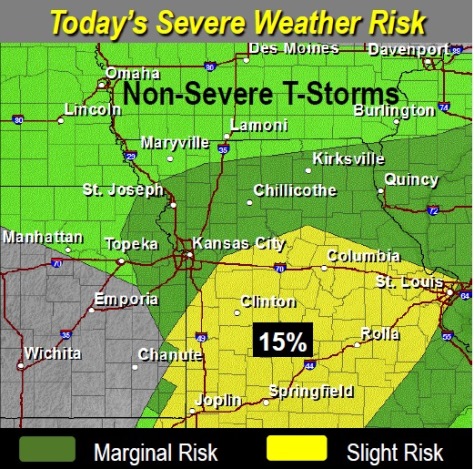
The severe weather risk today is higher south of Wyandotte County. (National Weather Service graphic)
Some rain and storms moved through the area this morning, and there may be a second round of thunderstorms later today, according to the National Weather Service.
The second round of thunderstorms may form by mid-afternoon the region and then move east during the early evening.
Strong to severe thunderstorms are possible, with the greatest threat east of I-35 and south of I-70.
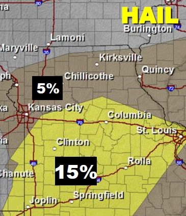
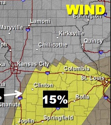
The primary severe threats to this storm are large hail, damaging winds and dangerous cloud-to-ground lightning, according to the weather service.
Weather service forecast maps showed that Wyandotte County is to the north of the worst part of this strong storm.
The forecast gave a 50 percent chance of rain Tuesday, and the high will be near 53, according to the weather service forecast.
Tonight, there is a 20 percent chance of rain, with a low around 41, the weather service said.
Wednesday, expect a 30 percent chance of showers and thunderstorms after 1 p.m., the weather service said. The high will be near 64 Wednesday. The low on Wednesday night will be around 35, according to the weather service.
Rain is not in the forecast for the rest of the week.
Those who have already planted gardens should take note that Thursday night’s predicted low is around 30 degrees, and Friday night’s low is around 31. Daytime highs for Thursday and Friday are 51 and 46.
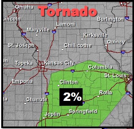
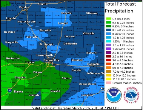
Saturday’s high will be 52, and Sunday’s 69, according to the weather service. The lows will be 40 on Saturday night and 42 on Sunday night. Hail potential (National Weather Service graphic) Tornado risk (National Weather Service graphic) Wind risk (National Weather Service graphic) Precipitation forecast (National Weather Service graphic)
Rain chances tonight and early Tuesday. (National Weather Service graphic)
Thunderstorms are likely after midnight until Tuesday morning, according to the National Weather Service.
A few of the thunderstorms could produce hail and heavy rain in the region, the weather service said.
Most of Monday will be sunny with a high near 62, the weather service said.
It will be past midnight when showers and thunderstorms are possible, according to the weather service. After 1 a.m., the chance of rain is 80 percent. An east wind of 9 to 13 mph may gust as high as 18 mph tonight, the weather service said. The low tonight will be 47 degrees.
On Tuesday, showers and thunderstorms will be possible mainly after 1 p.m., according to the weather service. The high will be 67, and an east wind of 11 mph will become southwest in the afternoon.
Tuesday night, the low will be 45, and winds may gust as high as 18 mph, the weather service said. Wednesday, the skies will be partly sunny with a high near 68.
Send your news and comments to Wyandotte Daily at news@wyandottepublishing.com. Rain chances Tuesday afternoon and evening. (National Weather Service graphic) Rainfall chances tonight through Tuesday night. (National Weather Service graphic) Tuesday’s severe weather chances. (National Weather Service graphic)