Temperatures in high 80s today

Photo by Mary Rupert

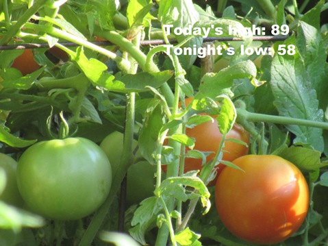
Pleasant weather continues on Tuesday, with a high near 89 in the forecast from the National Weather Service.

Winds will be out of the southwest at 11 to 15 mph, gusting as high as 22 mph today, the weather service said. There is a chance for storms south of the Kansas City area, in the central part of the state.

Dry weather is in the forecast through the end of this week, according to the weather service.

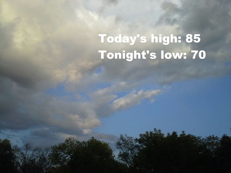
After cooler and drier air moving into the area on Wednesday and Thursday, when temperatures will be in the low to mid-80s, the temperatures will return to the high 80s on Friday and Saturday, the weather service said.

Today, it will be sunny, with a high near 89 and a southwest wind of 11 to 15 mph, becoming northwest in the afternoon, the weather service said. Winds may gust as high as 22 mph.

Tonight, it will be mostly clear, with a low of 58 and a north wind of 6 to 11 mph, according to the weather service.

Wednesday, it will be sunny, with a high near 84 and a west northwest wind of 5 to 11 mph, the weather service said.

Wednesday night, it will be mostly clear, with a low of 57, according to the weather service. A north wind around 5 mph will become calm in the evening.

Thursday, it will be sunny, with a high near 82 and a light and variable wind, the weather service said.

Thursday night, it will be clear, with a low of 63, according to the weather service.

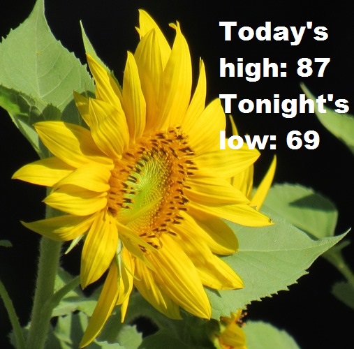
Friday, it will be sunny, with a high near 88, the weather service said.

Friday night, it will be clear, with a low of 70, according to the weather service.

Saturday, it will be sunny, with a high near 87, the weather service said.

Saturday night, it will be mostly clear, with a low of 64, according to the weather service.

Sunday, it will be mostly sunny, with a high near 83, the weather service said.

Sunday night, it will be mostly clear, with a low of 66, according to the weather service.

Monday, it will be sunny, with a high near 88, the weather service said.

Pleasant Labor Day weather ahead

Photo by Mary Rupert

Pleasant weather is expected today with sunshine and winds 8 to 10 mph from the southwest, according to the National Weather Service.

A late summer, early fall quiet weather pattern will continue this week. Dry weather is anticipated through the end of the upcoming week, the weather service said.

A cool front is expected to move through the area on Tuesday night and Wednesday.

Today, Labor Day, it will be sunny with a high near 87 and a southwest wind of 8 to 10 mph, the weather service said.

Tonight, it will be mostly clear, with a low of 69 and a south wind of 8 to 10 mph, according to the weather service.

Tuesday, it will be sunny, with a high near 89 and a south southwest wind of 11 to 15 mph, becoming northwest in the afternoon, the weather service said. Winds may gust as high as 22 mph.

Tuesday night, it will be clear, with a low of 58, according to the weather service. A north northwest wind of 5 to 9 mph will become calm after midnight.

Wednesday, it will be sunny, with a high near 81 and a light northwest wind becoming north northwest 5 to 9 mph in the morning, the weather service said.

Wednesday night, it will be clear, with a low of 58, according to the weather service.

Heavy rains cause flash floods

Photo by Steve Rupert
An exit from southbound I-635 to westbound I-70 was closed this morning in the heavy rain. (KC Scout photo)
An accident was reported near I-635 and Metropolitan around 7:50 a.m. Friday. (KC Scout photo)
Rainfall totals forecast for the area. (National Weather Service graphic)
Severe weather outlook. (National Weather Service graphic)

A flood advisory is in effect through 10:15 a.m. Friday, according to the National Weather Service.

Heavy rain moved through Wyandotte County this morning, leaving several accidents in its wake.

As a result of the rains, an exit from southbound I-635 to westbound I-70 was closed, and accidents were reported at I-435 near Donahoo Road, I-70 near Fairfax Trafficway and I-635 near Metropolitan,

Now that rains have moved through the area, the weather service said it will be mostly dry in the afternoon and early evening, with isolated showers possible.

More thunderstorms are possible Friday evening into Friday night, the weather service said. Strong storms will be possible, along with some minor flooding.

In Wyandotte County, the rain is forecast to be mainly after 3 a.m. Saturday, according to the weather service.

Today, rain should be ending after 11 a.m. The high will be near 85 with a south southwest wind of 6 to 9 mph. Between a half and three-quarters inch of rain is in the forecast.

Tonight, there is a 60 percent chance of showers and thunderstorms, mainly after 3 a.m., according to the weather service. The low will be around 70 with a calm wind. Between a quarter and half-inch of rain is possible.

Saturday, there is a 60 percent chance of showers and thunderstorms, mainly before 1 p.m., the weather service said. It will gradually become mostly sunny, with a high near 80 and a north wind of 3to 7 mph. Between a quarter and half-inch of rain is possible.

Saturday night, it will be mostly clear, with a low of 61 and a north wind of 5 mph becoming calm in the evening, according to the weather service.

Sunday, it will be sunny, with a high near 81 and a light north northwest wind, according to the weather service.

Sunday night, it will be clear, with a low around 63, according to the weather service.

Monday, Labor Day, it will be sunny, with a high near 86, the weather service said.

Monday night, it will be clear, with a low of 68, according to the weather service.

Tuesday, it will be sunny, with a high near 87, the weather service said.

Tuesday night, it will be clear, with a low around 59, according to the weather service.

Wednesday, it will be sunny, with a high near 80, the weather service said.

Wednesday night, it will be clear, with a low around 58, according to the weather service.

Thursday, it will be sunny, with a high near 82, the weather service said.