Cold, windy weather in today’s forecast

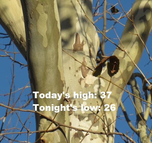
Today’s high will be near 37 with northwest wind gusts as high as 24 mph, according to the National Weather Service forecast.

Temperatures went from 64 on Sunday to freezing wind chills today. At 9 a.m. the temperature was 31 degrees with a wind chill of 22, according to the weather service.

Temperatures will begin to warm up Tuesday, with a high near 40, rising to 51 on Wednesday and 61 on Thursday. Friday’s high will be 66, while Saturday, it will be 46, the weather service said. There is an opportunity for a midlatitude cyclone that could affect the Plains region Friday and Saturday, according to the weather service.

Today, there will be increasing clouds, with a high near 37, the weather service said. A north northwest wind of 6 to 13 mph will gust as high as 24 mph.

Tonight, there will be increasing clouds, with a low of 26, according to the weather service. A light and variable wind will become southeast 5 to 9 mph after midnight, with winds gusting up to 20 mph.

Tuesday, it will be mostly cloudy, with a high near 40, the weather service said. A south wind of 7 to 14 mph will gust as high as 24 mph.

Tuesday night, it will be mostly cloudy, then gradually becoming mostly clear, with a low of 28 and a light south wind, according to the weather service.

Wednesday, it will be sunny, with a high near 51, the weather service said. A calm wind will become south 5 to 8 mph in the afternoon.

Wednesday night, it will be mostly cloudy, with a low of 40, according to the weather service.

Thursday, it will be mostly sunny, with a high near 61, the weather service said.

Thursday night, it will be partly cloudy, with a low of 40, according to the weather service.

Friday, it will be mostly sunny, with a high near 66, the weather service said.

Friday night, it will be mostly cloudy, with a low of 32, according to the weather service.

Saturday, it will be mostly sunny, with a high near 46, the weather service said.

Saturday night, it will be mostly clear, with a low of 30, according to the weather service.

Sunday, it will be sunny, with a high near 54, the weather service said.

Today’s high to be near 65

Photo by Mary Rupert

A little cooler than Thursday, the high for Friday will be near 65, according to the National Weather Service forecast.

The area will have dry and above normal temperatures for the next few days, the weather service said.

Temperatures are expected to trend back toward normal next week, with highs in the 40s, according to the weather service.

Today it will be sunny, with a high near 65, the weather service said. A west wind of 6 to 10 mph will become north in the afternoon, and winds could gust as high as 21 mph.

Tonight, the low will be around 37 with a north northeast wind of 9 mph, according to the weather service.

Saturday, it will be sunny, with a high near 52, the weather service said. An east wind of 8 to 11 mph will gust up to 20 mph.

Saturday night, it will be mostly cloudy, with a low of 43, according to the weather service. An east wind of 7 mph will become south after midnight, with winds gusting as high as 18 mph.

Sunday, it will be partly sunny, with a high near 60, the weather service said. A south wind of 7 to 14 mph will become northwest in the afternoon, and winds could gust as high as 26 mph.

Sunday night, it will be partly cloudy, with a low of 27, according to the weather service.

Monday, it will be mostly sunny, with a high near 39, the weather service said.

Monday night, it will be mostly cloudy, with a low of 29, according to the weather service.

Tuesday, it will be partly sunny, with a high near 42, the weather service said.

Tuesday night, it will be mostly cloudy, with a low of 26, according to the weather service.

Wednesday, it will be mostly sunny, with a high near 42, the weather service said.

Wednesday night, it will be partly cloudy, with a low of 31, according to the weather service.

Thursday, it will be mostly sunny, with a high near 51, the weather service said.

Today’s high to be 74

Unseasonably warm weather today will result in a high temperature of 74, according to the National Weather Service.

The record high in the Kansas City area for Dec. 2 is 70, set in 1956, so records may fall today, the weather service said.

Slightly cooler weather is predicted for Friday, with a high near 65, then temperatures will fall into the 50s on the weekend, according to the weather service. On Monday, the high will be near 43.

Today, it will be sunny, with a high near 74 and a west wind around 6 mph becoming calm in the morning, the weather service said.

Tonight, it will be clear, with a low around 46 and a calm wind becoming southeast around 5 mph in the evening, according to the weather service.

Friday, it will be sunny, with a high near 65, the weather service said. A light and variable wind will become north northeast 5 to 10 mph in the afternoon. Winds may gust up to 20 mph.

Friday night, it will be mostly clear, with a low of 37, according to the weather service. A north northeast wind of 9 mph will gust as high as 18 mph.

Saturday, it will be mostly sunny, with a high near 52 and an east wind of 7 to 10 mph, gusting as high as 20 mph, the weather service said.

Saturday night, it will be mostly cloudy, with a low of 43, according to the weather service.

Sunday, it will be partly sunny, with a high near 58, the weather service said.

Sunday night, it will be mostly clear, with a low of 27, according to the weather service.

Monday, it will be mostly sunny, with a high near 43, the weather service said.

Monday night, it will be mostly cloudy, with a low of 32, according to the weather service.

Tuesday, it will be partly sunny, with a high near 51, the weather service said.

Tuesday night, it will be partly cloudy, with a low of 28, according to the weather service.

Wednesday, it will be mostly sunny, with a high near 44, the weather service said.