As temperatures today reach a high of 77 with mostly sunny skies, the National Weather Service is advising residents to be concerned about the potential for fire hazards as the dry weather continues.
Today, a north northeast wind will be 12 to 17 mph in the afternoon, the weather service said, gusting as high as 26 mph. A dry cold front is settling into the region.
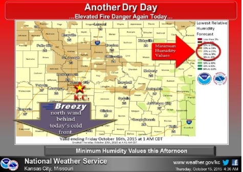
With low relative humidity values, about 20 to 30 percent in the afternoon, and increasing wind speeds in the afternoon, there will be an elevated fire weather danger this afternoon, the weather service said.
If you still have vegetables outdoors in the garden, be alert on Friday night and Saturday, as the morning temperatures could dip down to near freezing in the region, creating the first frost of the season in some areas, according to the weather service.
Tonight, the low will be around 41, the weather service said. The north northwest wind will be 7 to 10 mph, according to the weather service.
Friday, the high will be near 61 with sunny skies and a north wind of 5 to 10 mph, the weather service said.
Friday night’s forecast is partly cloudy with a low of 39, according to the weather service. A north wind around 5 mph will become calm.
On Saturday, it will be partly sunny with a high near 58, and a southeast wind of 7 to 9 mph, the weather service said. Saturday night, expect partly cloudy skies with a low of 45.
Sunday’s forecast is mostly sunny and a high near 67, according to the weather service. Sunday night, it will be partly cloudy with a low of 53.