A storm with heavy lightning and rain moved through Wyandotte County this morning. Storms could continue throughout the day today.
An outage map from the Board of Public Utilities showed about 440 customers without power around 9:32 a.m. Tuesday.
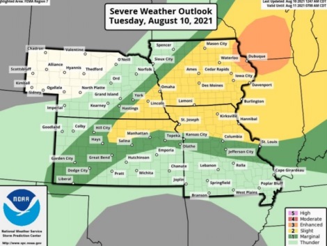
The National Weather Service forecast says more storms are coming today.
The storms will be in the afternoon and evening, generally along and north of I-70, according to the weather service.
The storms could have isolated winds up to 60 mph, brief heavy downpours, isolated hail up to quarter-sized and very low tornado risk, the weather service said.
Wyandotte County also is under an excessive heat warning from 2:50 a.m. Aug. 10 through 8 p.m. Aug. 12, according to the weather service.
The heat index could rise as high as 107 today, the weather service said, with temperatures reaching a high of 96.
Residents are advised to drink plenty of fluids, stay in an air-conditioned room, stay out of the sun, and check on relatives and neighbors, according to the weather service. Never leave children and pets unattended in vehicles. Those who work or spend time outside should take extra precautions. When possible, they should reschedule strenuous activities to early morning or evening.
Today, there is a 30 percent chance of showers and thunderstorms, mainly after 4 p.m., the weather service said. The high will be near 96 with a heat index as high as 107. A south southwest wind of 10 to 13 mph will gust as high as 22 mph. New rainfall amounts could be less than a tenth of an inch.
Tonight, there is a 30 percent chance of showers and thunderstorms, mainly before 1 a.m., according to the weather service. The low will be around 77 with a south southwest wind of 8 to 10 mph, gusting as high as 20 mph. Less than a tenth of an inch of rain is expected.
Wednesday, it will be mostly sunny and hot, with a high near 98 and a heat index as high as 109, the weather service said. A south southwest wind of 10 to 13 mph will gust as high as 22 mph.
Wednesday night, there is a 20 percent chance of showers and thunderstorms, with a low of 76, according to the weather service. There will be a south southwest wind of 6 to 10 mph.
Thursday, there is a 20 percent chance of showers and thunderstorms after 1 p.m., with a high near 97, the weather service said. A south southwest wind will be 6 to 8 mph.
Thursday night, there is a 40 percent chance of showers and thunderstorms, with a low of 73, according to the weather service. Less than a tenth of an inch of rain is expected.
Friday, there is a 40 percent chance of showers and thunderstorms, with a high near 87, the weather service said.
Friday night, it will be partly cloudy, with a low of 67, according to the weather service.
Saturday, it will be mostly sunny, with a high near 86, the weather service said.
Saturday night, it will be partly cloudy, with a low of 65, according to the weather service.
Sunday, it will be mostly sunny, with a high near 83, the weather service said.
Sunday night, it will be mostly clear, with a low of 65, according to the weather service.
Monday, it will be mostly sunny, with a high near 84, the weather service said.