A hot and humid week is ahead, with a heat advisory in effect from 1 p.m. Monday through 8 p.m. Thursday, according to the National Weather Service.
The heat index could rise to 109 on Monday and 106 in Tuesday in Wyandotte County, the weather service said.
Low temperatures at night will be in the mid-to-upper 70s, according to the weather service.
Residents are advised to drink plenty of fluids, stay in an air-conditioned room, stay out of the sun and check up on relatives and neighbors. Children and pets should never be left unattended in vehicles under any circumstances, the weather service said.
Those who spend time or work outdoors should take extra precautions. When possible, reschedule strenuous activities to early morning or evening, the weather service said. Wear lightweight and loose-fitting clothes when possible.
To reduce risk in outdoor work, schedule frequent rest breaks in shaded or air-conditioned environments. Anyone overcome by heat should be moved to a cool and shaded location. Heat stroke is an emergency and residents can call 911.
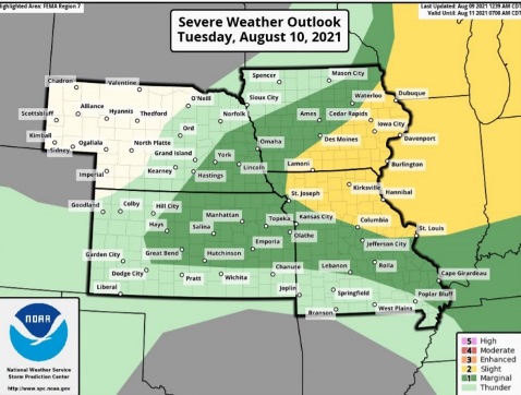
Strong to severe storms are possible after 1 p.m. Tuesday into Tuesday night, the weather service said. Storms could continue into Wednesday.
These storms have a potential of high winds, brief heavy rains and isolated hail, with a very low tornado threat, according to the weather service.
Despite smoke from western wildfires overspreading the region, the air quality index is good today, the weather service said. There is little to no risk for residents.
Today, it will be sunny with a high near 96 and heat index values as high as 109, the weather service said. There will be a south southwest wind of 8 to 10 mph.
Tonight, it will be mostly clear with a low of 79 and a south wind of 8 to 10 mph, according to the weather service.
Tuesday, there is a 30 percent chance of showers and thunderstorms after 1 p.m., with a high of 97, the weather service said. The heat index will be as high as 106. There will be a south southwest wind of 9 to 11 mph. Between a tenth and quarter-inch of rain is possible.
Tuesday night, there is a 40 percent chance of showers and thunderstorms, with a low of 77, with a south southwest wind of 7 to 10 mph. according to the weather service. Between a quarter and half-inch of rain is possible.
Wednesday, there is a 20 percent chance of showers and thunderstorms, the weather service said. It will be mostly sunny and hot, with a high near 97 and a south southwest wind of 11 mph, gusting as high as 18 mph.
Wednesday night, there is a 20 percent chance of showers and thunderstorms, with a low of 77, according to the weather service.
Thursday, it will be mostly sunny and hot, with a high near 97, the weather service said.
Thursday night, there is a 30 percent chance of showers, with a low of 72, according to the weather service.
Friday, it will be mostly sunny, with a high near 90, the weather service said.
Friday night, it will be partly cloudy, with a low of 66, according to the weather service.
Saturday, it will be mostly sunny, with a high near 87, the weather service said.
Saturday night, it will be mostly clear, with a low of 67, according to the weather service.
Sunday, it will be mostly sunny, with a high near 88, the weather service said.