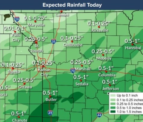
Ongoing minor to major river flooding will continue today and may be aggravated by additional rainfall today in the region, according to the National Weather Service.
Flash flooding may be possible south of a Kirksville to Gardner line where an additional 1 to 3 inches of rain is possible across saturated ground.
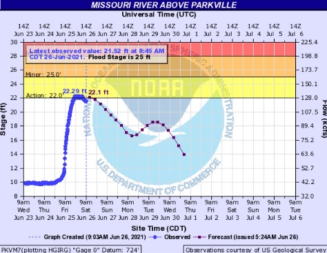
Hydrology charts from the USGS showed the Missouri River above Parkville, where the gauge is on the Missouri River at I-435 between Wyandotte and Platte counties, went up to the action stage overnight before receding.
A few storms this afternoon and evening in the region could be strong, according to the weather service. Winds up to 50 mph and small hail are possible with the storms.
In Wyandotte County, there is a 60 percent chance of showers and thunderstorms likely, mostly after 1 p.m., according to the National Weather Service. The high will be near 81 with a southwest wind of 10 mph. Between a tenth and quarter-inch of rain is possible.
Tonight, there is a 70 percent chance of showers and thunderstorms, mainly before 1 a.m., according to the weather service. The low will be near 68 with a southwest wind of 5 to 9 mph becoming calm after midnight. Less than a tenth of an inch of rain is possible.
More rain is in the forecast for Sunday. There is a 40 percent chance of showers and thunderstorms, with a high near 79 and a north northeast wind of 3 to 6 mph, the weather service said.
For more weather information, visit www.weather.gov.