
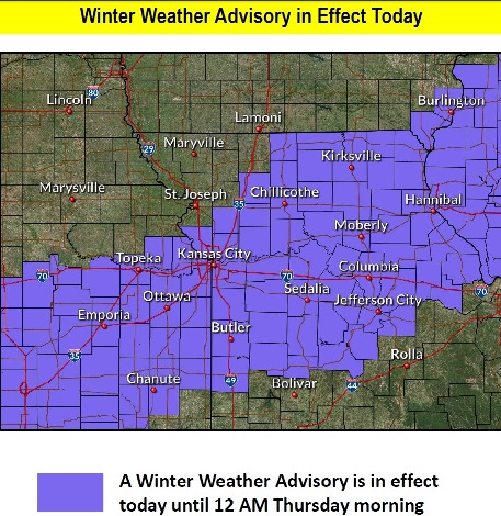
Snow was falling at 9 a.m. in Wyandotte County, and a winter weather advisory is in effect from 9 a.m. today through noon Thursday, Feb. 13, according to the National Weather Service.
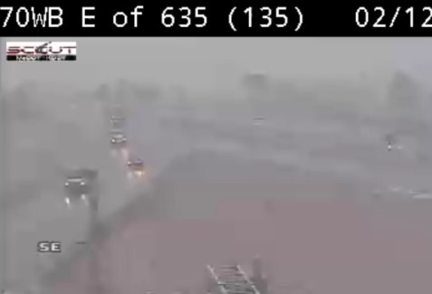
The temperature at 9 a.m. was 33 degrees, with light snow, fog and mist in the area.
Light snow this morning is expected to change to a rain-snow mix this afternoon, and then change again to snow this evening, the weather service said. A slight change in the temperatures, which will be near freezing, could result in more or less snow, according to the weather service.
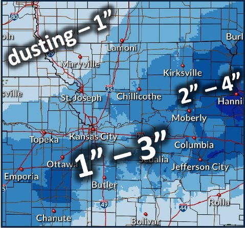
Wyandotte County’s forecast is for less than an inch of snow. Snow should move to the east and out of the area by early Thursday morning, the weather service said.
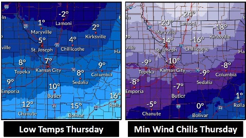
Temperatures will drop from the 30s today to a low of 6 tonight, and a high near 17 on Thursday, the weather service said. Wind chill readings will be between minus 8 and 2 tonight, and will be between minus 2 and minus 12 on Thursday.
The quick drop in temperatures may create black ice and slick spots on roads on Thursday morning, according to the weather service.
Today, snow is falling and is forecast to continue before 1 p.m., followed by rain and snow, the weather service said. The high will be near 37 with a south wind of 6 mph becoming calm. Total daytime snow accumulation is expected to be less than 1 inch.
Tonight, there is a 70 percent chance of snow, mainly before 11 p.m., according to the weather service. The low will be around 6. Wind chill values will be between minus 8 and 2. It will be blustery, with a north northwest wind of 5 to 10 mph increasing to 16 to 21 mph after midnight. Winds may gust up to 33 mph. New snow accumulation of less than 1 inch is possible.
Thursday, it will be sunny, with a high near 17 and wind chill readings between minus 2 and minus 12, the weather service said. A north northwest wind of 9 to 16 mph will gust as high as 25 mph.
Thursday night, it will be mostly clear, with a low of 8 and a calm wind, according to the weather service.
Friday, it will be sunny, with a high near 33 and a light southeast wind becoming south 5 to 10 mph in the morning, the weather service said. Winds may gust as high as 20 mph.
Friday night, it will be partly cloudy, with a low of 30, according to the weather service.
Saturday, it will be mostly cloudy, with a high near 48, the weather service said.
Saturday night, it will be partly cloudy, with a low of 29, according to the weather service.
Sunday, it will be mostly sunny, with a high near 51, the weather service said.
Sunday night, it will be mostly cloudy, with a low of 40, according to the weather service.
Monday, Presidents Day, it will be mostly cloudy, with a high near 58, the weather service said.
Monday night, it will be mostly cloudy, with a low of 32, according to the weather service.
Tuesday, it will be mostly cloudy, with a high near 40, the weather service said.
For more weather information, visit www.weather.gov.