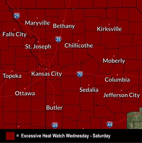
An excessive heat watch has been issued for Wednesday afternoon through Saturday evening, according to the National Weather Service.
Temperatures will rise into the 90s, with a heat index ranging from 100 to 110 Wednesday through Saturday, the weather service said.
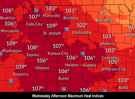
On Wednesday, the heat index could reach 107 here, according to the weather service. The prolonged duration of heat and humidity could become dangerous to those who are most vulnerable, including young children and the elderly, the weather service said.
Night temperatures could be uncomfortable for some. Overnight temperatures will reach a low only of 79 on Wednesday night and Thursday night. On Sunday, the extreme heat may break, and temperatures will reach a high of 93.
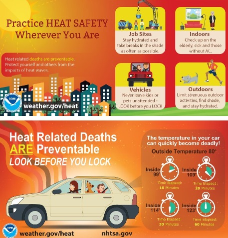
This will be the first prolonged period of heat this season, and some people may not have acclimated to the heat, according to the weather service. Heat illnesses will be possible for those spending prolonged time outside or time indoors in non-air-conditioned locations.
Residents are advised to drink plenty of fluids, stay in an air-conditioned room, stay out of the sun and check up on relatives and neighbors, the weather service said.
The Missouri River at Parkville, which includes Wyandotte County in its coverage area, is currently in action stage, which is below flood stage. The Kansas River at 23rd Street, where the gauge is near Kansas Avenue and the state line, is currently below flood stage and below action stage.
There is no rain in the forecast for the next week, according to the weather service forecast.
Today, it will be partly sunny, then gradually becoming sunny, with a high near 89 and a light and variable wind, the weather service said.
Tonight, it will be partly cloudy, with a low of 74 and a south southeast wind of 6 mph, according to the weather service.
Wednesday, it will be mostly sunny and hot, with a high near 97 and heat index values as high as 107, the weather service said. A south wind of 6 to 15 mph will gust as high as 24 mph.
Wednesday night, it will be mostly clear, with a low of 79 and a south wind around 10 mph, gusting as high as 22 mph, according to the weather service.
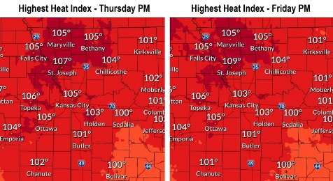
Thursday, it will be sunny and hot, with a high near 97, the weather service said. A south southwest wind of 10 to 13 mph will gust as high as 26 mph.
Thursday night, it will be mostly clear, with a low of 79, according to the weather service.
Friday will be sunny and hot, with a high near 97, the weather service said.
Friday night will be mostly clear, with a low of 78, according to the weather service.
Saturday, it will be sunny with a high near 96, the weather service said.
Saturday night, it will be mostly clear with a low of 76, according to the weather service.
Sunday, it will be mostly sunny with a high near 93, the weather service said.
Sunday night, it will be mostly clear, with a low around 73, according to the weather service.
Monday, it will be mostly sunny, with a high near 91, the weather service said.