Showers and thunderstorms are in the forecast again on Wednesday in Wyandotte County, according to the National Weather Service.
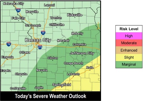
Storms may be strong, and isolated severe storms are possible, the weather service said. The main threat will be strong winds and hail up to the size of a quarter.
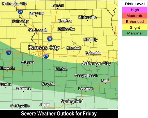
Severe storms also will be possible on Friday along and north of I-70, according to the weather service. Hazards may include large hail, damaging winds, flash flooding and a tornado.
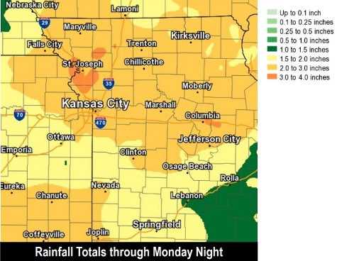
The weather service said heavy rain will be possible with these storms, and heavy rain is expected to continue through the weekend. From 2 to 4 inches of rain are in the forecast through the weekend, which could increase the risk of flash flooding and aggravate ongoing river flooding.
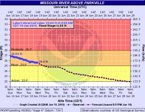
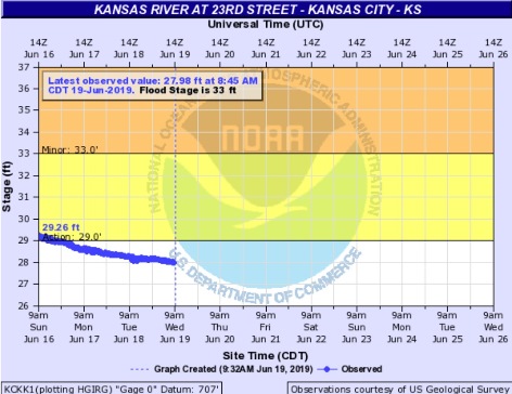
Flooding continues in the region on the Missouri River. In Wyandotte County, the Missouri River at Parkville, including Wyandotte County, is in minor flood stage and declining. The Kansas River now is below flood stage in Wyandotte County.
Today, there will be a 60 percent chance of showers and thunderstorms, mainly after 1 p.m., the weather service said. The high will be near 76 with a north wind around 7 mph. New rainfall amounts between a tenth and a quarter-inch are expected.
Tonight, there is a 30 percent chance of showers and thunderstorms before 10 p.m., according to the weather service. Patchy fog will be possible after 4 a.m. Thursday. Tonight’s low will be around 61 with a north northwest wind of 5 to 7 mph becoming calm in the evening. Less than a tenth of an inch of rain is expected.
Thursday, the high will be near 85 with a calm wind becoming south 5 to 8 mph in the morning, the weather service said.
Thursday night, there is a 20 percent chance of showers and thunderstorms after 1 a.m., according to the weather service. The low will be around 69 with a south wind of 5 to 9 mph.
Friday, there is a 20 percent chance of showers and thunderstorms, with a high near 91 and a south southeast wind of 7 to 14 mph, the weather service said.
Friday night, there is a 40 percent chance of showers and thunderstorms, with a low of 73, according to the weather service. Between a quarter and half-inch of rain is possible.
Saturday, there is a 30 percent chance of showers and thunderstorms, with a high near 90, the weather service said.
Saturday night, there is a 50 percent chance of showers and thunderstorms, with a low of 70, according to the weather service.
Sunday, there is a 30 percent chance of showers and thunderstorms, with a high near 84, the weather service said.
\
Sunday night, there is a 30 percent chance of showers and thunderstorms, with a low of 65, according to the weather service.
Monday, it will be mostly sunny with a high near 84, the weather service said.
Monday night, the low will be around 65 with partly cloudy skies, according to the weather service.
Tuesday, it will be mostly sunny with a high near 87, the weather service said.
For more weather information, visit www.weather.gov.