Heavy rain and thunderstorms are possible late tonight in Wyandotte County, according to the National Weather Service.
Strong to damaging winds will be the main threat of the storm. Also, 1 to 2 inches of rain are possible from tonight through Wednesday, the weather service said.
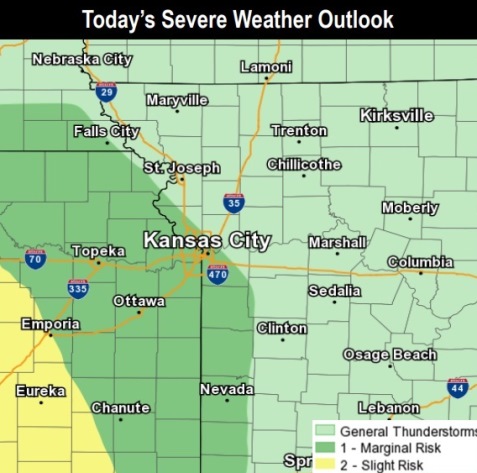
Several rounds of scattered storms capable of heavy rain are expected through the week and into the weekend, according to the weather service. An additional 2 to 5 inches are possible across portions of the area, which could aggravate river flooding.
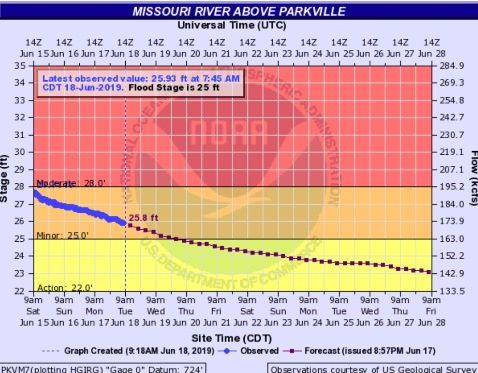
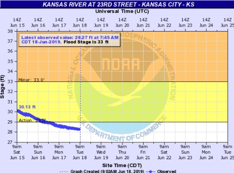
In Wyandotte County, the Missouri River is in minor flood stage and declining at the Parkville gauge, which is located on I-435 between Wyandotte and Platte counties. The Kansas River now has receded below flood stage. The additional rain for the next week could cause a rise in river levels, according to forecasters.
Today, there is a 20 percent chance of showers and thunderstorms after 4 p.m., the weather service said. The high will be near 82 with a calm wind becoming southeast around 6 mph in the afternoon.
Tonight, there is an 80 percent chance of showers and thunderstorms, mainly after 1 a.m., according to the weather service. The low will be around 65. A south southwest wind of 6 mph will become east northeast in the evening. Between three-quarters and 1 inch of rain are possible.
Wednesday, there is a 70 percent chance of showers and thunderstorms, mainly before 1 p.m., the weather service said. Patchy fog is possible before 7 a.m. The high will be near 76 with an east wind of 7 mph becoming north in the afternoon. Between a half and three-quarters of an inch of rain are possible.
Wednesday night, there is a 20 percent chance of showers and thunderstorms before 1 a.m., with a low of 60, according to the weather service. A south wind of 6 mph will become calm after midnight.
Thursday, it will be mostly sunny with a high near 85 and a calm wind becoming south southwest around 5 mph, the weather service said.
Thursday night, there is a 30 percent chance of showers and thunderstorms after 1 a.m., with a low of 68, according to the weather service.
Friday, there is a 40 percent chance of showers and thunderstorms before 1 p.m., with a high near 90, the weather service said.
Friday night, there is a 30 percent chance of showers and thunderstorms, with a low of 72, according to the weather service.
Saturday, there is a 30 percent chance of showers and thunderstorms, with a high near 86, the weather service said.
Saturday night, there is a 40 percent chance of showers and thunderstorms, with a low of 66, according to the weather service.
Sunday, there is a 30 percent chance of showers and thunderstorms, with a high near 84, the weather service said.
Sunday night, there is a 40 percent chance of showers and thunderstorms, with a low of 64, according to the weather service.
Monday, there is a 30 percent chance of showers and thunderstorms, with a high near 84, the weather service said.