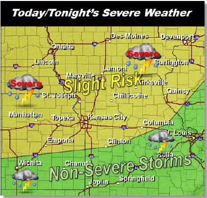
Several storms could visit the area this afternoon and early Wednesday morning.
Damaging winds and large hail are the most likely threats, with a chance of tornadoes near the Missouri-Iowa state border to the northwest.
Heavy rains are expected to accompany the storms, with areas along and north of Highway 36, near the St. Joseph, Mo., area, possibly receiving up to 2 inches of rain. Rain amounts near I-70 are expected to fall within the three-quarters of an inch to one-and-a-half inch range, according to the weather service.
Today’s high will be near 87, with south winds of 10 to 15 mph and gusts as high as 22 mph.
Cooler weather is expected Wednesday, with a high near 75. Thursday, the temperatures drop again, and the high will be near 66. On Friday, the high will be near 60.
Weekend weather is sunny and 64 on Saturday, and sunny and 72 on Sunday.