Rain continues in today’s forecast from the National Weather Service.
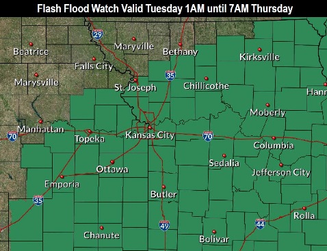
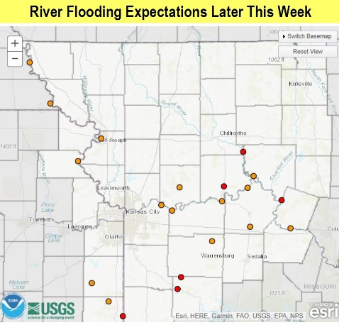
The area also is under a flash flood watch from 1 a.m. April 30 through 7 a.m. May 2, according to the weather service.
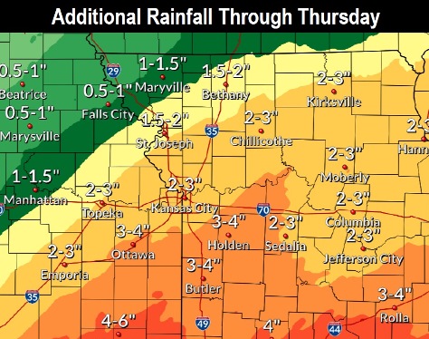
Between three-fourths and 1 inch of rain may fall today, and between a quarter and half-inch of rain may fall tonight, the weather service said. On Wednesday, a light amount of rain could fall.
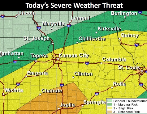
Wyandotte County is at a slight risk for severe storms from 3 p.m. to 7 p.m. today. The risk increases for an area south of Route 50, according to the weather service.
Today, there will be showers and thunderstorms, with some producing heavy rain, the weather service said. The high will be near 64 with an east northeast wind of 7 to 10 mph. Between three-quarters and 1 inch of rain is possible.
Tonight, there is a 70 percent chance of showers and thunderstorms, mainly before 1 a.m., according to the weather service. Some of the storms could produce heavy rain. The low will be around 54 with a northeast wind of 5 to 9 mph becoming west northwest after midnight. Between a quarter and half-inch of rain is possible.
Wednesday, there is a 30 percent chance of showers and thunderstorms, mainly after 7 a.m., the weather service said. Some of the storms could produce heavy rain. The high will be near 70 with a west northwest wind of 6 mph becoming light and variable. Less than a tenth of an inch of rain is expected.
Wednesday night, there is a 60 percent chance of showers and thunderstorms, and some could produce heavy rain, according to the weather service. The low will be around 55 with a northeast wind of 7 to 9 mph. Between a tenth and quarter-inch of rain is possible.
Thursday, there is a 30 percent chance of showers and thunderstorms before 1 p.m., the weather service said. The high will be near 67 with a north wind of 8 to 10 mph. Less than a tenth of an inch of rain is expected.
Thursday night, there is a 20 percent chance of showers after 1 a.m., with a low of 50, according to the weather service.
Friday, it will be partly sunny with a high near 68, the weather service said.
Friday night, it will be mostly cloudy, with a low of 51, according to the weather service.
Saturday, it will be mostly sunny, with a high near 74, the weather service said.
Saturday night, there is a 30 percent chance of showers after 1 a.m., with a low of 55, according to the weather service.
Sunday, there is a 30 percent chance of showers, with a high near 73, the weather service said.
Sunday night, there is a 40 percent chance of showers, with a low of 55, according to the weather service.
Monday, there is a 40 percent chance of showers, with a high near 71, the weather service said.
For more weather information, visit www.weather.gov.