Rain is possible today through Thursday, and again on the weekend, as today’s temperatures may reach a high near 64, according to the National Weather Service.
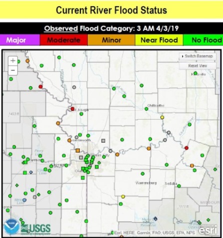
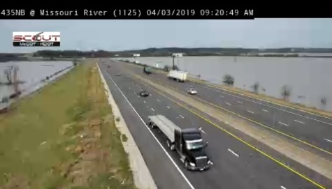
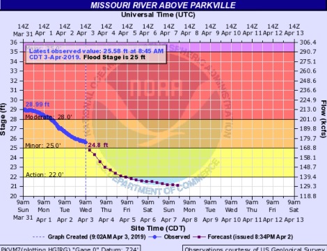
Flooding continues along the Missouri River, and is declining in most places. The Missouri River at Parkville, which includes Wyandotte County, this morning was in the minor flood stage, and could decline out of flood stage and into action stage later today, according to hydrology charts.
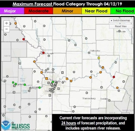
As the river levels decline, the amount of water being released into the Missouri River from reservoirs in the Dakotas is increasing, according to the Corps of Engineers’ forecast for the Missouri River below Gavins Point Dam. Water releases were scheduled to be at 39,000 cubic feet per second on April 2, and are scheduled to increase to 42,000 cfs on April 3, then to 45,000 cfs on April 4, to 48,000 cfs on April 5, to 51,000 cfs on April 6 and to 55,000 cfs on April 7. Forecasts are subject to change.
The Missouri River at Kansas City, according to this forecast, is decreasing from 201,200 cfs on April 2 to 186,400 cfs on April 3 and is forecast to decrease to 176,400 cfs on April 5.
There is still the potential for more flooding later in the spring and summer, according to the Corps of Engineers and weather forecasters.
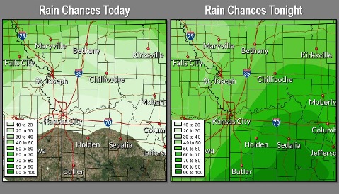
Today, there is a 20 percent chance of showers between 1 p.m. and 4 p.m., and a high near 64, the weather service said. A south southeast wind of 8 to 14 mph will gust as high as 24 mph.
Tonight, there is a 60 percent chance of rain, with thunderstorms also possible after 4 a.m., according to the weather service. The low will be around 50 with a southeast wind of 7 to 10 mph. Less than a tenth of an inch is possible, except higher amounts are possible in thunderstorms.
Thursday, there is a 40 percent chance of showers and thunderstorms before 10 a.m., then a chance of showers between 10 a.m. and 1 p.m., the weather service said. The high will be near 60 with an east southeast wind of 6 mph becoming north in the afternoon. Less than a tenth of an inch of rain is possible, except higher amounts are possible in thunderstorms.
Thursday night, the low will be around 46 with a northeast wind of 6 mph becoming calm in the evening, according to the weather service.
Friday, it will be partly sunny with a high near 69 and a calm wind becoming south southeast around 6 mph in the afternoon, the weather service said.
Friday night, there will be a 20 percent chance of showers after 1 a.m., with a low around 52, according to the weather service.
Saturday, there is a 40 percent chance of showers and thunderstorms after 1 p.m, with a high near 72, the weather service said.
Saturday night, there is a 50 percent chance of showers, with a low of 55, according to the weather service.
Sunday, there is a 40 percent chance of showers, with thunderstorms also possible after 1 p.m., the weather service said. The high will be near 68.
Sunday night, there is a 30 percent chance of showers after 1 a.m., with a low of 48, according to the weather service.
Monday, it will be partly sunny with a high near 66, the weather service said.
Monday night, it will be partly cloudy, with a low of 47, according to the weather service.
Tuesday, it will be mostly sunny with a high near 66, the weather service said.