Springlike weather is in the forecast today, with a high near 53, as Missouri River flooding continues to the north of the Kansas City area.
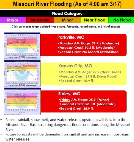
According to the National Weather Service, flooding on the Missouri River at Parkville, Missouri, which is across the river from Kansas City, Kansas, affects Leavenworth, Wyandotte and Platte counties.
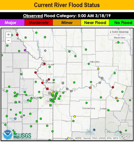
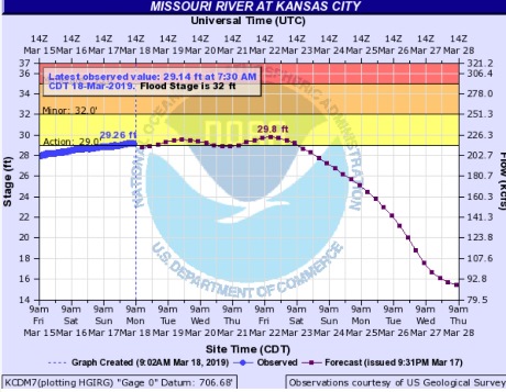
At this time, Wyandotte County is not anticipated to have the same major flooding as has occurred in Nebraska and cities to the north, and forecasters are keeping their attention on river levels and rainfall for the next week. The forecast is subject to change every day.
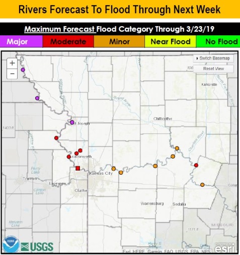
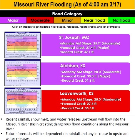
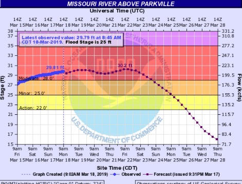
The Missouri River at Parkville is currently in the moderate flood stage, according to hydrology charts. Also in the moderate flood stage is the Missouri River at Leavenworth. Atchison, Kansas, and St. Joseph, Missouri, also are listed as being in the moderate flood stage at this time.
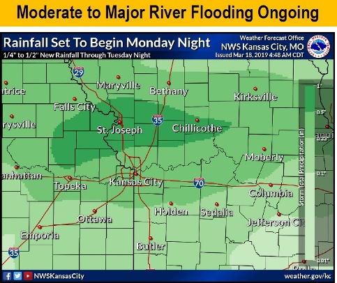
Light to moderate rain is expected Tuesday along the Missouri River basin, according to forecasters. This rainfall could aggravate already swollen and flooding rivers and streams, the weather service said.
Areas along and north of I-70 also could see a dusting of snow Tuesday morning, according to the weather service.
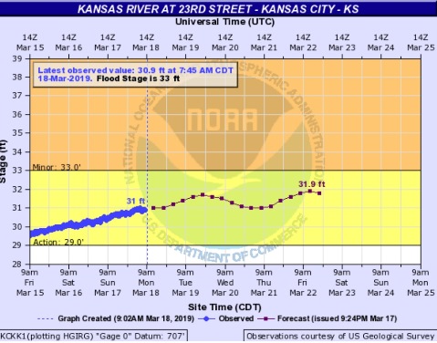
Many rivers still in flood may continue to rise during this time, the weather service said.
Some points along the Missouri River, north of the Kansas City area, are expected to reach moderate to major flood stage and break previous record crests, according to the weather service.
Recent rainfall, snow melt and water releases upstream will flow into the Missouri River basin creating dangerous flood conditions along the Missouri River, the weather service said. Future river forecasts will depend on rainfall and any increase in upstream water releases, according to the weather service.
Today, the high will be near 53 with sunny skies and a light and variable wind, the weather service said.
Tonight, there will be a 50 percent chance of scattered showers after 1 a.m., with a low of 39, according to the weather service. A light and variable wind is forecast. Less than a tenth of an inch of rain is possible.
Tuesday, there is a 70 percent chance of showers, with a high near 51, the weather service said. An east wind of 6 to 11 mph will become south southeast in the afternoon. Between a tenth and a quarter-inch of rain is possible.
Tuesday night, there is an 80 percent chance of showers, mainly before 1 a.m., according to the weather service. The low will be around 38 with an east northeast wind of 6 to 8 mph becoming north northwest after midnight. Between a tenth and quarter-inch of rain is possible.
Wednesday, it will be partly sunny, with a high near 53 and a northwest wind of 7 to 9 mph, the weather service said.
Wednesday night, it will be mostly clear with a low of 35, according to the weather service.
Thursday, it will be sunny with a high near 58, the weather service said.
Thursday night, it will be mostly clear with a low of 37, according to the weather service.
Friday, it will be mostly sunny with a high of 63, the weather service said.
Friday night, there is a 30 percent chance of showers after 1 a.m., with a low of 45, according to the weather service.
Saturday, there is a 50 percent chance of showers, with a high near 60, the weather service said.
Saturday night, there is a 30 percent chance of showers, with a low of 48, according to the weather service.
Sunday, there is a 40 percent chance of showers, with a high near 65, the weather service said.
For more weather information, see www. weather.gov or https://www.weather.gov/media/eax/sitreport/SitReport1.pdf.