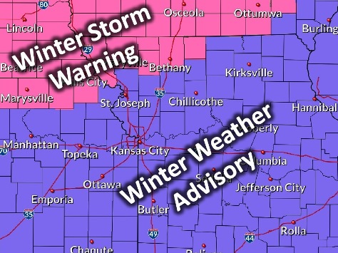
Wyandotte County is under a winter weather advisory from 4 p.m. Tuesday, Feb. 19, through 9 a.m. Wednesday, Feb. 20, according to the National Weather Service.
Periods of snow, sleet or freezing rain will cause travel difficulties, the weather service said. Motorists should expect slippery roads and limited visibility, and use caution while driving.
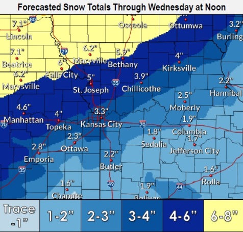
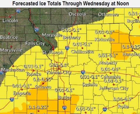
With this storm, from 2 to 4 inches of snow is possible, with a tenth of an inch of ice accumulation possible, according to the weather service.
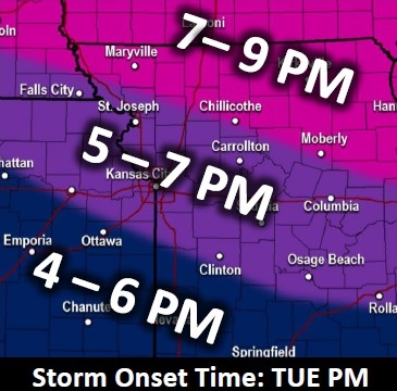
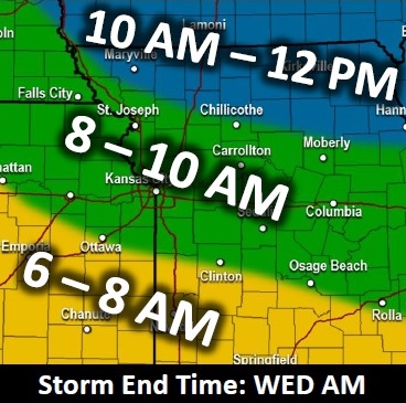
A minor to moderate impact on Tuesday afternoon traffic is expected. On Wednesday morning, snow and possibly ice-covered roads and difficult travel conditions are expected with the commute, according to the weather service.
Snow will change to light freezing rain and drizzle during the predawn hours on Wednesday, the weather service said. A tenth of an inch of ice also is possible.
Today, the weather service said snow is likely, mainly after 5 p.m. Today’s high will be near 31, with an east wind of 8 to 11 mph. There is a 60 percent chance of precipitation.
Tonight, there is a 100 percent chance of precipitation, with snow, possibly mixed with freezing rain, in the Wyandotte County forecast, according to the weather service. The low will be around 27 with an east wind of 7 to 15 mph, gusting as high as 22. New snow accumulation of 2 to 4 inches is possible, and new ice accumulation of less than a tenth of an inch is possible.
Wednesday, there is a 30 percent chance of freezing rain before 11 a.m., then a chance of rain between 11 a.m. and noon, the weather service said. The high will be near 35, with a south southeast wind of 6 to 10 mph becoming west southwest in the afternoon. Winds could gust as high as 20 mph.
Wednesday night, it will be partly cloudy, with a low of 19, and a southwest wind of 3 to 8 mph, according to the weather service.
Thursday, it will be sunny with a high near 43 and a light and variable wind becoming east southeast 5 to 7 mph in the afternoon, according to the weather service.
Thursday night, it will be partly cloudy, with a low of 27, according to the weather service.
Friday, it will be mostly sunny, with a high near 47, the weather service said.
Friday night, there is a 60 percent chance of rain, mainly after midnight, with a low of 36, according to the weather service.
Saturday, there is a 90 percent chance of rain before noon, then showers after noon, with a high near 49, the weather service said.
Saturday night, there is a 70 percent chance of rain, mixing with snow after 11 p.m., with a low of 27. It will be blustery.
Sunday, it will be mostly sunny, with a high near 38, the weather service said.
Sunday night, it will be mostly clear, with a low of 22, according to the weather service.
Monday, it will be mostly sunny, with a high near 41, the weather service said.
For more weather information, visit www.weather.gov.