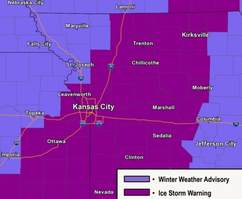

Wyandotte County remains under an ice storm warning through noon Thursday, according to the National Weather Service.
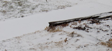
The area was hit by an ice storm overnight, with a thin layer of snow on top of it.
Most of the precipitation is over, with a chance of snow remaining before 9 a.m. Thursday, the weather service said.
Blowing snow may continue through about 11 a.m. Thursday, according to the weather service. With the winds, power outages and tree damage are possible.
The weather service strongly discouraged travel, and those who travel should have an emergency kit with food and water.
The temperature was 14 degrees at 8 a.m., with a wind chill of minus 2.
Today’s high will be near 17, with a wind chill between minus 5 and zero. A northwest wind of 9 to 14 mph will increase to 16 to 21 mph in the morning, and winds could gust as high as 36 mph, the weather service said.
Tonight, it will be clear with a low of 3 and a wind chill between minus 1 and minus 9, according to the weather service. A west northwest wind of 8 to 14 mph will gust as high as 32 mph.
Friday, it will be sunny with a high near 21 and wind chill values between minus 1 and minus 11, the weather service said. A northwest wind of 5 to 8 mph will become light and variable in the afternoon.
Friday night, it will be clear with a low of 9 and wind chill values between minus 1 and 4, according to the weather service. An east southeast wind will be 3 to 7 mph.
Saturday, it will be sunny with a high near 35 and a south southeast wind of 7 to 10 mph, the weather service said.
Saturday night, there is a 60 percent chance of snow after midnight, according to the weather service. The low will be around 26.
Sunday, there is a 50 percent chance of snow, mixing with rain after 10 a.m., then gradually ending, the weather service said. The high will be near 39.
Sunday night, it will be mostly cloudy with a low of 24, according to the weather service.
Monday, there is a 50 percent chance of snow before 1 p.m., then a chance of rain and snow between 1 p.m. and 3 p.m., then a chance of rain after 3 p.m., the weather service said. The high will be near 38.
Monday night, there is a 60 percent chance of rain and snow, becoming all snow after 8 p.m., according to the weather service. The low will be around 27.
Tuesday, there is a 50 percent chance of snow, with a high near 35, the weather service said.
Tuesday night, it will be partly cloudy, with a low of 18, according to the weather service.
Wednesday, it will be mostly sunny, with a high near 34, the weather service said.