Wyandotte County is under a high wind warning from now until 2 p.m. Monday, according to the National Weather Service.
Sustained winds of 17 to 22 mph approaching 24 to 29 mph, gusting as high as 40 mph this morning are possible, the weather service said.
The winds may make travel difficult, especially for high-profile vehicles on east-west oriented roads, according to the weather service.
The weather service said winds that are 40 mph or gusts of 58 mph or more can lead to property damage.
Today’s forecast will include falling temperatures as a cold front with arctic air moves through, according to the weather service.
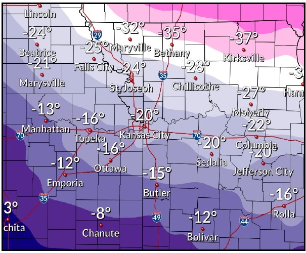
The temperature was 35 degrees at 8 a.m., and fell to 28 degrees at 9 a.m. in Wyandotte County, with temperatures expected to fall to around 20 degrees by 5 p.m. in Wyandotte County, the weather service said.
As temperatures are expected to fall even more through Wednesday, Wyandotte County is under a wind chill watch from 6 p.m. Tuesday, Jan. 29, through Wednesday, Jan. 30, according to the weather service.
Dangerously cold wind chills will be possible on Tuesday night through Wednesday night, the weather service said. The temperature on Tuesday night will be minus 3, with a wind chill between minus 7 and minus 17. The temperature on Wednesday will see a high near 5, while the temperature Wednesday night may have a low of 3. Residents are advised to cover up if they have to go out, and frostbite may occur if any skin is exposed to the cold.
Today will be mostly sunny with the temperature falling to around 20 by 5 p.m., the weather service said. It will be breezy, with a north northwest wind of 17 to 22 mph increasing to 24 to 29 mph in the morning, and winds gusting up to 40 mph.
Tonight, it will be mostly clear, with a low of 15, according to the weather service. A northwest wind of 12 to 17 mph will become west 5 to 10 mph after midnight, and winds could gust as high as 26 mph.
Tuesday, there will be increasing clouds, with a high near 23, the weather service said. A southwest wind of 7 to 15 mph will become north in the afternoon, with winds gusting as high as 22 mph.
Tuesday night, it will be mostly cloudy with a low near minus 3, according to the weather service. Wind chill values will be between minus 7 and minus 17. A north wind of 8 to 11 mph will gust as high as 20 mph.
Wednesday will be mostly sunny and cold, with a high near 5, the weather service said. A north northwest wind of 5 to 11 mph will gust as high as 18 mph.
Wednesday night will be partly cloudy, with a low around 3, according to the western service.
Thursday, it will be mostly cloudy with a high near 31, the weather service said.
Thursday night, it will be mostly cloudy, with a low of 25, according to the weather service.
Friday, it will be mostly sunny, with a high near 43, the weather service said.
Friday night, it will be mostly cloudy, with a low of 37, according to the weather service.
Saturday, it will be partly sunny, with a high near 54, the weather service said.
Saturday night, it will be mostly cloudy, with a low of 42, according to the weather service.
Sunday, there is a 40 percent chance of showers, with a high near 53, the weather service said.