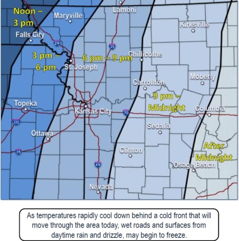
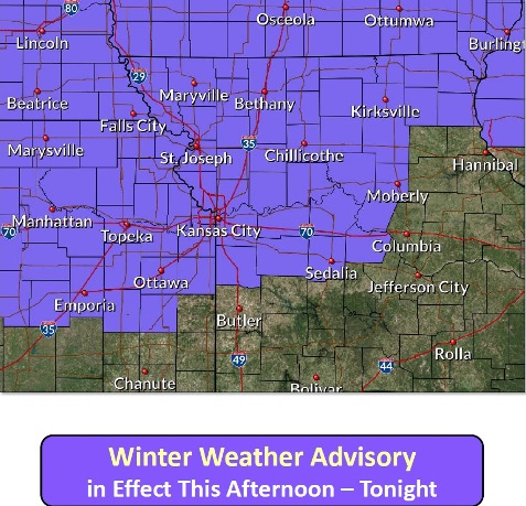
A strong cold front will move through the area this afternoon through tonight, bringing drizzle, rain, freezing drizzle and snow, according to the National Weather Service.
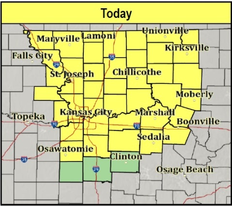
A winter weather advisory is in effect for Wyandotte County from 5 p.m. Tuesday through 3 a.m. Wednesday, according to forecasters.
Drizzle and rain will occur ahead of the front, and as temperatures drop below freezing, flash freezing of water on the roads is possible, the weather service said.
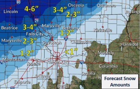
As temperatures become colder, freezing drizzle will make a transition to snow, according to the weather service.
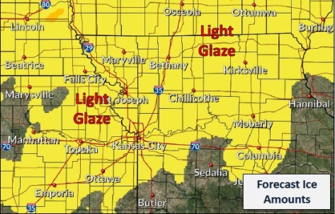
By late tonight, a light glaze is possible throughout the area, the weather service said.
On Thursday night through Saturday night, a few clipper systems could bring light snow accumulation, according to the weather service.
Check for changes to today’s weather forecast at www.weather.gov.
Today, there is a 70 percent chance of rain during the day, with a high near 48, the weather service said. Patchy fog is possible after 10 a.m. An east southeast wind of 6 to 15 mph will become northwest in the afternoon, with gusts as high as 22 mph possible. Between a quarter and half-inch of rain is possible.
Tonight, there is a 40 percent chance of drizzle, snow and freezing drizzle before 1 a.m., then a chance of snow between 1 a.m. and 3 a.m., according to the weather service. The low will be around 19 with a northwest wind of 14 to 17 mph, gusting as high as 29 mph. Less than a tenth of an inch of precipitation is in the forecast.
Wednesday, it will be sunny with a high near 30, the weather service said. A northwest wind of 6 to 14 mph will become west southwest in the afternoon, with winds gusting as high as 26 mph.
Wednesday night, the low will be around 23 with a west southwest wind of 5 to 7 mph becoming northwest after midnight, according to the weather service.
Thursday, the high will be near 27 with a north northwest wind of 8 to 15 mph, gusting as high as 24 mph, the weather service said.
Thursday night, it will be partly cloudy with a low of 8, according to the weather service.
Friday, it will be partly sunny with a high near 35, the weather service said.
Friday night, the low will be around 16 with mostly cloudy skies, according to the weather service.
Saturday, there is a 30 percent chance of snow before noon, with a high near 32, the weather service said.
Saturday night, it will be mostly cloudy, with a low of 24, according to the weather service.
Sunday, it will be mostly sunny, with a high near 39, the weather service said.
Sunday night, it will be partly cloudy with a low of 22, according to the weather service.
Monday, there is a 30 percent chance of snow, with a high near 28, the weather service said.