Showers and thunderstorms are in today’s forecast, mainly after 4 p.m.
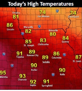
The National Weather Service said today’s high will be near 89. The chance of rain is 60 percent.
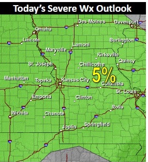
Storms at 8 a.m. were located in Nebraska, to the north of the Kansas City area.
The cold front and storms moving through the area are not expected to result in severe weather. For any storms that do approach severe storms, isolated large hail and sporadic strong winds will be the main concerns, the weather service said.
Showers and storms then will remain in the forecast through much of the remainder of the week. Weak wind fields aloft should limit the overall severe weather threat, but stray severe storms cannot be ruled out Thursday and Friday, according to the weather service.
Temperatures through the period will return to below normal limits by Thursday, as highs only warm into the upper 70s to mid-80s.