The National Weather Service says temperatures will drop today in Wyandotte County, bringing in a chance for freezing drizzle and snow.
The temperature was 30 degrees at 8 a.m. and 28 degrees at 9 a.m. Friday, and is expected to drop today, according to the weather service.
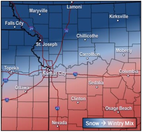
Freezing drizzle is possible tonight before midnight in Wyandotte County, then there is a 30 percent chance of snow and freezing drizzle between midnight and 2 a.m., followed by a chance of snow after 2 a.m., the weather service said.
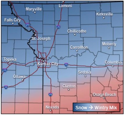
The weather service said there is a chance of a dusting of snow or precipitation north of the Missouri River from late this afternoon through the overnight, while the freezing drizzle is expected to begin tonight south of the Missouri River.
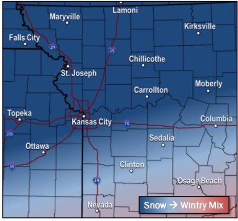
On Saturday, intermittent wintry weather is possible, mainly after noon in Wyandotte County, where there is a 30 percent chance of snow with a high of 22.
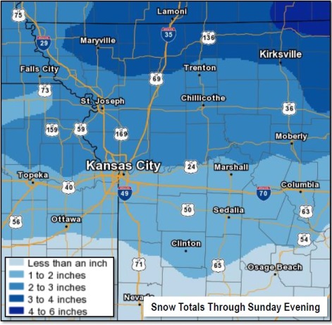
Saturday night, from 1 to 3 inches of snow is possible in Wyandotte County, with a 70 percent chance of snow, according to the weather service. The low will be around 12 with a north wind of 8 to 11 mph.
Sunday, there will be a 30 percent chance of snow before noon, with a high near 29, the weather service said. There will be a north northwest wind of 5 to 7 mph becoming light and variable in the afternoon.
Sunday night, the low will be around 11, according to the weather service.
Monday, the high will be near 38 with sunny skies, the weather service said.
Monday night, the low will be around 24 with mostly cloudy skies, according to the weather service.
Tuesday, the high will be near 43 with partly sunny skies, the weather service said.
Tuesday night, the low will be around 24, according to the weather service.
Wednesday, the high will be near 50 with mostly sunny skies, the weather service said.