Temperatures in the lower to middle 90s combined with high levels of atmospheric moisture will result in a sultry air mass today, according to the National Weather Service.
A heat index of more than 100 will be common across the Greater Kansas City area.
All persons who are performing outside activities should exercise extreme caution to prevent any heat-related illnesses, the weather service said.
Those with small children are reminded to check the back seat of their vehicles for any children who may have fallen asleep during travel.
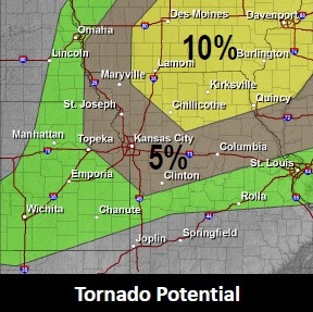
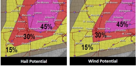
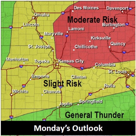
Cooler and less humid air will arrive overnight behind a strong cold front that will bring showers and thunderstorms to much of the Kansas City area late this afternoon and evening, according to the weather service.
The thunderstorms have a possibility of large hail, damaging winds, a few tornadoes and flash flooding.
The temperature at 9 a.m. Monday was 81 degrees with a heat index of 85.