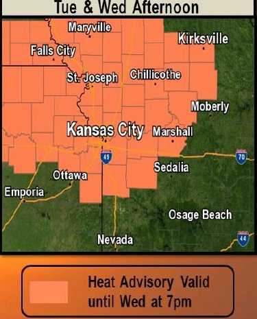
Today, temperatures in Wyandotte County may reach a high of 95, with a heat index as high as 103, according to the National Weather Service. A heat advisory is in effect through 7 p.m. Wednesday.
A prolonged heat spell is expected through at least Wednesday, with afternoon highs in the lower to middle 90s and heat index values between 100 and 107 in the region, the weather service said.
A cold front is expected to move into the region Thursday and Friday, providing some relief from the heat, according to the weather service.
Thunderstorms will be possible along and ahead of the front late Wednesday into Friday, according to the forecast. The threat for strong or severe storms appears fairly low at this time, but the storms will produce rain, and local flooding is possible, the weather service said.
Residents are advised to wear lightweight and loose-fitting clothing today, drink plenty of fluids, stay out of the sun and check on relatives and neighbors, according to the weather service. Those who work or spend time outside should take extra precautions and reschedule strenuous activities to early morning or evening when possible.
The Salvation Army at 6723 State Ave., Kansas City, Kansas, is opening its facility as a cooling shelter between 8 a.m. and 5 p.m. today.
Today’s forecast is sunny, with a high near 95 and a heat index as high as 103, the weather service said. A south wind of 10 to 14 mph will gust as high as 20 mph.
Tonight, expect mostly clear skies with a low of 77, and a south wind of 8 to 13 mph, according to the weather service.
Wednesday, it will be sunny with a high near 96, and a heat index as high as 104, the weather service said. There will be a south southwest wind of 8 to 10 mph.
Wednesday night, expect a low of 75 with a south wind of 8 mph, according to the weather service.
Thursday, there is a 40 percent chance of showers and thunderstorms after 1 p.m., with a high near 92, the weather service said, and a southeast wind of 3 to 5 mph. Less than a tenth of an inch of rain is expected.
Thursday night, there is a 60 percent chance of showers and thunderstorms, mainly after 1 a.m., according to the weather service. The low will be around 73 with new rainfall amounts between a quarter and half-inch of rain.
Friday, there will be a 40 percent chance of showers and thunderstorms before 1 p.m., with a high near 88, the weather service said.
Friday night, it will be partly cloudy with a low of 71, according to the weather service.
Saturday, there will be mostly sunny skies with a high near 91, the weather service said.
Saturday night, the low will be around 69 with mostly clear skies, according to the weather service.
Sunday, it will be sunny with a high near 90, the weather service said.
Sunday night, skies will be mostly clear with a low of 70, according to the weather service.
Monday, it will be sunny with a high near 91, the weather service said.
For more weather information, visit www.weather.gov.