
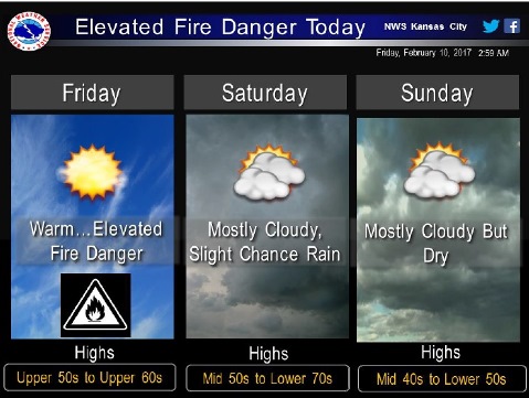
Strong southwesterly winds coupled with temperatures in the upper 50s to upper 60s and dry fuels will lead to an elevated fire weather danger today, the National Weather Service said.
Outdoor burning is discouraged, according to the weather service, because any fires that do develop may quickly burn out of control.
Today’s high will reach an unseasonable temperature of 68, with sunny skies, the weather service said. It will be windy, with a southwest wind of 13 to 20 mph, gusting as high as 30 mph.
Tonight, the low will be around 47, with partly cloudy skies and a southwest wind of 5 to 10 mph, according to the weather service.
Saturday, expect patchy fog before noon, with a high near 64, the weather service said. A south southeast wind of around 6 mph will become north northwest in the afternoon.
Saturday night, the low will be around 39 with mostly cloudy skies and a north wind of 6 to 11 mph, the weather service said.
Sunday, the high will be near 48 with mostly cloudy skies, gradually clearing, according to the weather service. A north northwest wind of 10 to 15 mph may gust as high as 29 mph.
Sunday night, the low will be around 28 with partly cloudy skies, the weather service said.
Monday, expect mostly sunny skies with a high near 48, according to the weather service.
Monday night’s low will be around 31 with mostly cloudy skies, the weather service said.
Tuesday, it will be sunny with a high near 51, the weather service said.
Tuesday night, the low will be 30 with mostly clear skies, according to the weather service.