A large area of showers and thunderstorms will gradually weaken as it spreads from Kansas and west central Missouri towards central Missouri this morning.
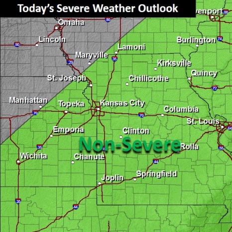
The National Weather Service said no severe weather is anticipated today. However, heavy rains up to an inch plus small hail were possible from the Kansas City area southward.
Much of the rain has already fallen early this morning in Kansas City, and rain was expected to be over by 11 a.m.
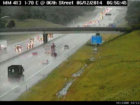
The rain caused several accidents in the Kansas City area. One was at I-635 and I-35, about 7:08 a.m.
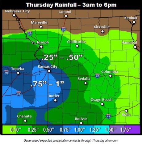
The heaviest rains were along and south of I-70 with local amounts over an inch possible.
At 8 a.m., K-5 in Leavenworth County was closed to all traffic at Seven-Mile Creek. Flood waters were over the roadway, and motorists were asked to use alternate routes.
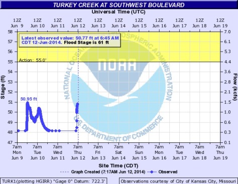
While widespread flooding is not expected, minor flooding is likely in those areas that are prone to excessive runoff and low water crossing areas, according to the weather service. The Kansas and Missouri rivers were well below flood stage at 7 a.m. Thursday.
Today’s high temperature will be 75 degrees.
Friday’s forecast is sunny and 77. Saturday, temperatures will be near 86 with mostly sunny skies.
The rain returns to the forecast with a 50 percent chance of showers and storms Saturday night. There is a 60 percent chance of thunderstorms on Sunday. Showers and thunderstorms remain in the forecast for Monday, Tuesday and Wednesday.