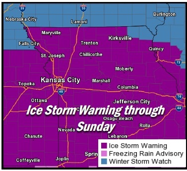
The National Weather Service has issued an ice storm warning from noon today through midnight Sunday, Jan. 16, for Wyandotte County.
Freezing rain or drizzle will begin to overtake much of the local area beginning this morning from south to north, with increasing chances expected during the afternoon and evening hours, the weather service said.
Hazardous roadways may form during the midafternoon to early evening hours Friday, according to the weather service. The best icing potential remains during the Saturday night into Sunday morning time period.
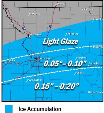
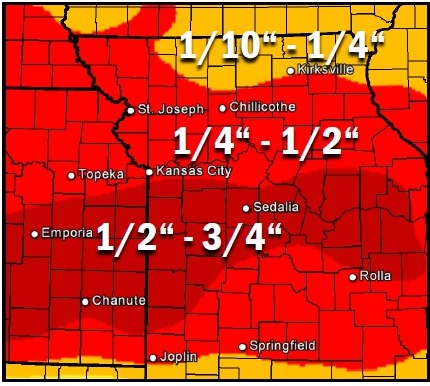
While total ice accumulations have trended downward, hazardous travel conditions remain possible, along with isolated power outages, the weather service said.
Freezing rain will develop Friday morning and spread north through the afternoon, according to the weather service. It may have an effect on the evening rush hour. The heaviest icing will generally be south of I-70, the weather service said.
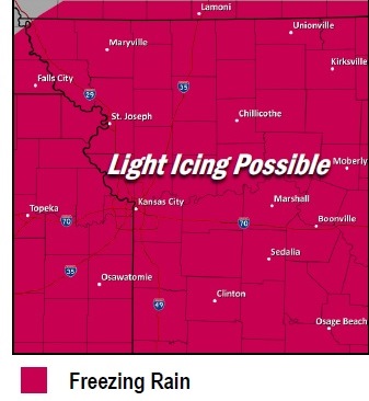
The weather service stated that light freezing rain is possible over the entire forecast area on Saturday. There will be periodic breaks during the day, which may keep the icing accumulations low during the period.
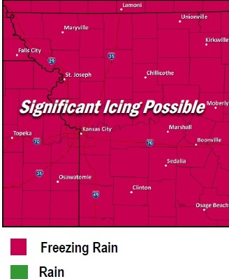
Saturday night into Sunday morning, the heaviest freezing rain is expected, with significant icing possible, the weather service said.
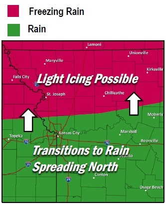
Sunday afternoon, temperatures will warm from the south to north, according to the weather service. Freezing rain is mainly confined to areas along or north of Highway 36, which runs through St. Joseph, Mo. The icing threat will diminish late Sunday night into Monday, the weather service said.
While ice accumulation may be light today, travel is strongly discouraged, the weather service said.
The weather service added that commerce likely will be severe affected. Those who travel should keep a flashlight, food and water in their vehicle in case of an emergency, according to the weather service.
Snapped power lines and fallen tree branches also are possible, according to the weather service.
Bridges and overpasses will be most susceptible to ice accumulation, the weather service said.
Today’s high is expected to be 27, while tonight’s low will be 23, according to the weather service.
Saturday, expect a high of 31, with a 30 percent chance of freezing rain, the weather service said. Saturday night’s low will be around 27, with freezing rain likely.
Sunday, there will be freezing rain before 1 p.m., then rain is likely. The high will be near 36, the weather service said.
Sunday night’s low will be about 36, with rain in the forecast after midnight, according to the weather service.
Monday, Martin Luther King Jr. Day, the high will be near 54 with a 70 percent chance of rain, mostly before noon, the weather service said.