An ice storm is likely to affect much of the region this weekend, according to the National Weather Service.
A winter storm watch is in effect from noon Friday, Jan. 13, until 2 p.m. Sunday, Jan. 15, the weather service said.
The storm will include freezing rain and freezing drizzle as early as Friday afternoon, with activity then continuing through Sunday night, the weather service said.
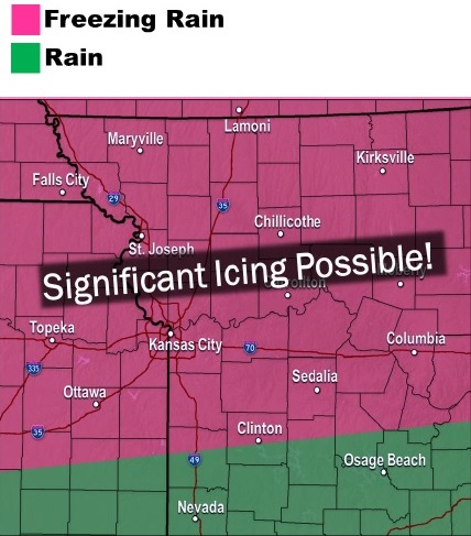
Significant icing is expected, with ice accumulations of one-fourth to three-fourths of an inch possible, according to the weather service.
Freezing rain is expected to develop Friday afternoon and spread north through the evening and overnight, the weather service said. This storm could affect the evening rush hour. The heaviest icing is expected south of I-70, according to the weather service.
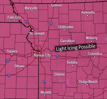
Saturday, light freezing rain is possible over the entire forecast area, the weather service said. Periodic breaks are expected through the day, which should keep icing accumulations low through the period.
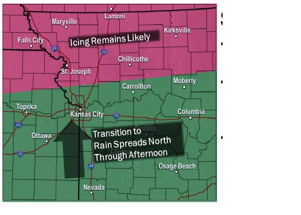
Saturday night into Sunday morning, the heaviest freezing rain is expected, according to the weather service. Significant icing is possible.
Sunday afternoon, temperatures will warm from the south to the north, the weather service said. Freezing rain is mainly confined to areas along or north of Route 36, which is in the St. Joseph, Mo., area. The icing threat will diminish late Sunday night into Monday, according to the weather service.
The weather service said widespreading icing is expected over the weekend, with significant travel effects across Missouri and Kansas.
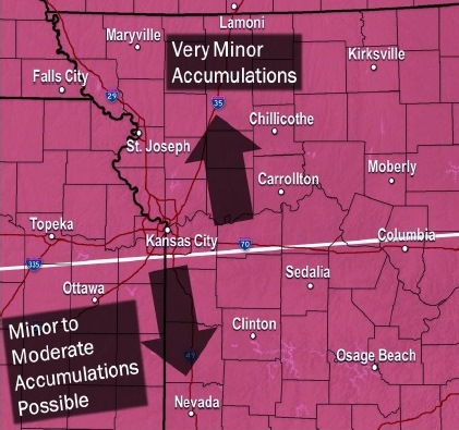
Power outages and downed tree limbs will be possible across the area, according to the weather service. Total ice accumulations of a quarter to three-fourths of an inch are possible, with higher amounts possible in certain areas, the weather service said.
Today, skies will be mostly sunny with a high near 31 and a north wind of 8 to 10 mph, the weather service said.
Tonight, expect mostly cloudy skies with a low of 18, and a northeast wind of 8 to 10 mph, according to the weather service.
Friday, the forecast calls for a 30 percent chance of freezing rain and sleet between noon and 1 p.m., then a chance of freezing rain after 1 p.m., according to the weather service. The high will be near 27, with an east northeast wind of 8 to 10 mph.
Friday night, there is a 60 percent chance of freezing rain, mainly before midnight, the weather service said. The low will be around 23, with an east northeast wind of 5 to 8 mph.
Saturday, there is a 50 percent chance of freezing rain. The high will be near 28 with a north northeast wind of 3 to 6 mph, according to the weather service.
Saturday night, there is a 70 percent chance of freezing rain with a low of 26, the weather service said.
Sunday, there is a 90 percent chance of freezing rain before 2 p.m., then rain is likely, according to the weather service. The high will be near 36.
Sunday night, expect an 80 percent chance of rain, with a low of 35, the weather service said.
On Monday, Martin Luther King Jr. Day, there is a 40 percent chance of rain before noon, according to the weather service. The high will be near 50.
Monday night, the low will be around 29, the weather service said.