A severe thunderstorm watch is in effect from 8:05 a.m. until 2 p.m. June 5 in Wyandotte County.
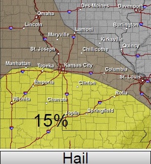
A cluster of severe storms will continue to move eastward across Kansas this morning, the National Weather Service said.
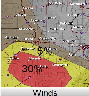
The strongest activity will continue east and take a southeastern turn as it reaches eastern Kansas with the highest risk for severe storms along a line from Paola to Clinton. The main risk will be damaging winds.
This storm has a risk of heavy rain and brief gusty winds. The storm is expected to be at its strongest in the morning on Thursday. Today’s high will be 77 degrees.
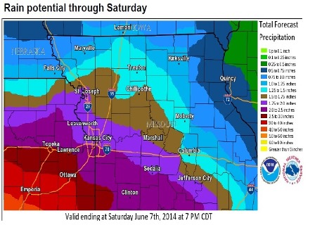
Additional thunderstorms are possible Thursday night, Friday and Friday night as well as on Saturday, according to the weather service. All the activity could become strong and produce heavy rain and additional flooding across much of the area.
Additional rainfall through this weekend may top 2 to 4 inches across the local area. This heavy rainfall, on top of already saturated grounds, could lead to additional flooding into early next week.