A storm system currently is moving south of Wyandotte County and Greater Kansas City, and is in the Emporia, Kan., and Ottawa, Kan., area, according to a National Weather Service radar map.
Several rounds of thunderstorms starting this morning are in the forecast for the region. Some areas received a lot of rain overnight and this morning.
A tropical plume of moisture from the remnants of Hurricane Newton will lie overhead through Friday night, the weather service said.
Storms will be very efficient rain makers, capable of producing very high rain rates, according to the weather service.
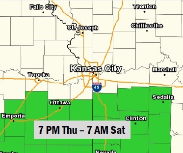
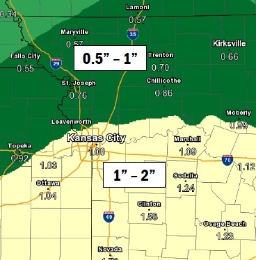
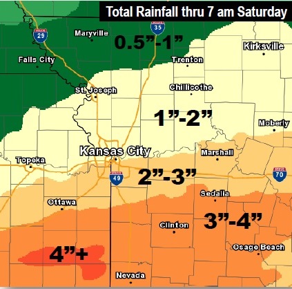
A second round of heavy rain storms starts tonight south of the Missouri River, according to the weather service. A third and final round is Friday night. Widespread 1 –to-3-inch rainfall with local amounts of 4-to-5 inches is likely, the weather service said. Flooding will be a concern.
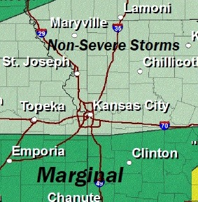
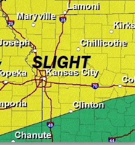
Strong to marginally severe storms are possible this afternoon and evening, the weather service said. Scattered severe storms are possible Friday afternoon and evening. The primary hazards on Friday include damaging winds, large hail, and locally heavy rainfall, according to the weather service.
The Thursday forecast calls for a high near 86, with a 60 percent chance of rain.
Tonight, expect a 60 percent chance of rain, along with storms, and a low of 71, the weather service said.
Friday, the chance of rain and storms is 40 percent, the weather service said. The high will be near 85. Between a quarter and half-inch of rain is possible.
Friday night, there is an 80 percent chance of rain and storms, the weather service said. The low will be 59, with a southwest wind of 8 to 10 mph becoming north northwest after midnight. Between a half and three-quarters inch of rain is possible.
Saturday’s forecast is sunny, with a high near 76.