Scattered thunderstorms are expected through Wednesday across the entire area, according to the National Weather Service.
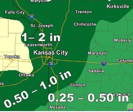
The most robust storms will have the potential for very heavy rainfall that may lead to localized flash flooding, the weather service said.
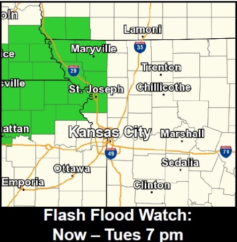
Heavier storms currently are to the north of Kansas City, Kan., and there is a flash flood watch to the north.
While heavy rainfall is the primary concern through Wednesday, a few storms may become strong during the afternoon and evening, according to the weather service.
Downburst winds up to 50 mph will be possible as storms quickly collapse, the weather service said.
Drier and cooler weather will arrive on Thursday, according to the weather service.
Today’s high will be near 87, and there is a 50 percent chance of scattered showers and thunderstorms, the weather service said.
Tonight’s chance of precipitation is 40 percent, with showers and storms still in the forecast. The low will be around 70, according to the weather service.
Wednesday’s weather will be a 60 percent chance of showers and thunderstorms, with a high near 80, the weather service said. The rain and storms likely will be between 10 a.m. and 1 p.m.
Thursday’s forecast is sunny, with a high near 80, according to the weather service.