Today, expect a slight chance of showers and thunderstorms after noon, according to the National Weather Service.
The high will be near 85 today, with an east northeast wind of 3 to 8 mph, the weather service said.
Tonight, expect a 40 percent chance of showers and thunderstorms, mainly after 1 a.m., according to the weather service. The low will be around 68.
The weather service said residents may expect several rounds of passing showers and thunderstorms through early next week. None of them are expected to be severe storms.
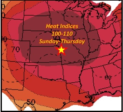
A prolonged heat wave is anticipated through most of next week, and perhaps all the way into next weekend, the weather service said.
While day to day chances for extreme heat will depend on possible passing storms or cloud cover, there is a strong signal pointing toward several days of heat index values well over 100 degrees across most of the area, according to the weather service.
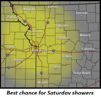
On Saturday, there is a 40 percent chance of showers and thunderstorms, with a high near 86, the weather service said.
Saturday night, the low will be around 73, with a south southeast wind of 9 mph, according to the weather service.
Sunday, the high will be near 94, and a south wind will be 9 to 16 mph, gusting to 23 mph, the weather service said.
Sunday night, the low will be around 75, according to the weather service.