A flood warning continues today for the Kansas River and the Missouri River in Wyandotte County.
A flood warning is in effect in Wyandotte County for the Kansas River at 23rd Street, according to the National Weather Service.
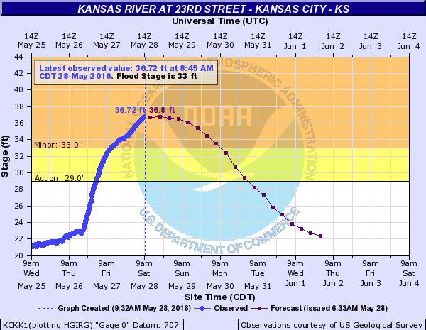
The Kansas River at 23rd Street in Kansas City, Kan., was in minor flood stage at 36.72 feet at 8:45 a.m. Saturday, according to NOAA hydrology charts. Flood stage is 33 feet.
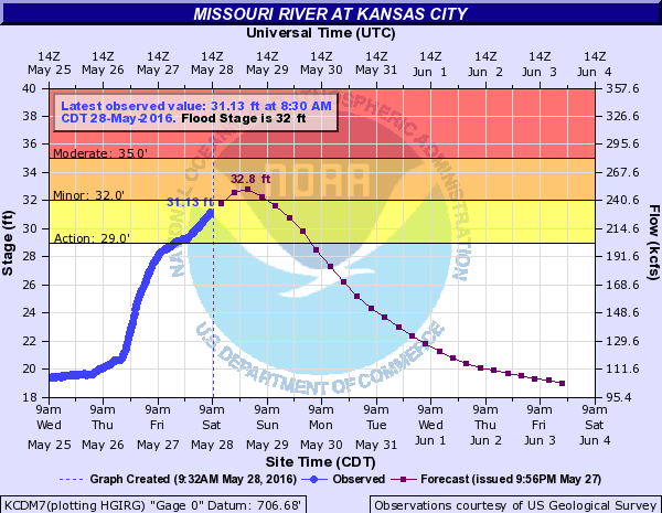
The Missouri River at Kansas City is projected to rise to flood stage of 32 feet on early Sunday morning. It was at 31.13 feet at 8:30 a.m. Saturday, according to NOAA hydrology charts.
The projections on flood stages are subject to change and may be monitored at http://water.weather.gov/ahps2/index.php?wfo=eax.
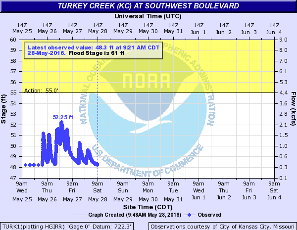
Turkey Creek at Southwest Boulevard remained below flood stage.
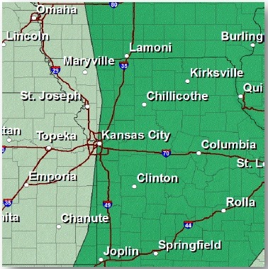
Flood warnings also are in effect for many rivers and streams in other counties surrounding Wyandotte County.
The National Weather Service advises motorists not to drive through flowing water. As little as 6 inches of water may cause you to lose control of your vehicle. Two feet of water will carry most vehicles away.
Today, the weather service stated that there is a chance for some afternoon thunderstorms in parts of the region. Large hail and high winds would be the main concern.
But the weather system that brought all the rain and flooding will finally exit the region, leaving dry and warm weather on Sunday, the weather service said.
There may be some storms returning in the first part of next week, and it is too early to determine how much severe threat there will be, although forecasters think the threat will be low.
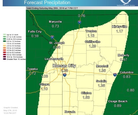
In addition to rain that has already fallen, rainfall amounts will range from three-fourths of one inch to an inch and three-quarters, with locally heavier amounts possible.
Today’s high will be near 80, with a southwest wind of 7 to 11 mph, according to the weather service. There is a 20 percent chance of showers between noon and 1 p.m., then a slight chance of showers and thunderstorms after 1 p.m.
Tonight, the low will be around 59, with a west southwest wind of 3 to 8 mph, the weather service said.
Sunday, expect a high of 84, sunny skies and a southwest wind of 3 to 6 mph, according to the weather service. There is a 20 percent chance of showers and thunderstorms after 1 p.m.
Sunday night, the low will be around 62 with a south wind of 3 to 5 mph, the weather service said.
Monday, Memorial Day, there will be a 50 percent chance of showers and thunderstorms, according to the weather service. The high will be near 81 with a south wind of 5 to 8 mph. Between a tenth and quarter of an inch of rain is possible.
On Monday night, there is a 40 percent chance of showers, with a low of 63, according to the weather service. New rainfall amounts between a tenth and quarter inch are possible.
For more weather information, visit www.weather.gov or listen to a weather radio.