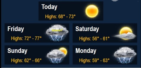
Today’s weather is expected to be quiet and dry, with thunderstorms returning Friday, according to the National Weather Service.
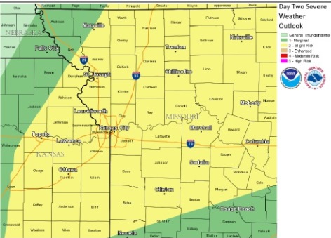
Some storms Friday may become strong to severe, the weather service said. Primary hazards may include dangerous cloud-to-ground lightning, hail, and gusty to possibly damaging winds.
Unseasonably cool temperatures will arrive Saturday into early next week, according to the weather service.
An unsettled pattern persists late Sunday into the middle of next week with multiple rounds of storm chances, the weather service said.
There may be concerns about the rise of rivers and streams with an increase in recent rain, plus more to come, according to the weather service.
Today, it will be sunny with a high near 72, the weather service said. A northwest wind of 6 to 14 mph may gust as high as 18 mph.
Tonight, the low will be around 52, according to the weather service.
Friday, the high will be near 76, with a 50 percent chance of showers and thunderstorms after 1 p.m., according to the weather service. There will be a southwest wind of 5 to 10 mph increasing to 13 to 18 mph in the afternoon, and gusting as high as 28 mph. New rainfall amounts between a tenth and quarter-inch are expected, with higher amounts possible in thunderstorms.
Friday night, there is a 30 percent chance of showers and thunderstorms before 1 a.m., with a low around 45, according to the weather service. A north northwest wind of 7 to 13 mph is predicted.
Saturday, it will be mostly sunny with a high near 59, and a north northwest wind of 8 to 11 mph, the weather service said.