There will be a heightened fire danger for Wyandotte County and the region this afternoon, and thunderstorms are likely on Thursday, according to the National Weather Service.
After summer-like temperatures reaching 87 today, along with winds from 15 to 21 mph and gusts as high as 29 mph, there will be a 30 percent chance of showers tonight after 1 a.m.
Thunderstorms could arrive by late Wednesday night with thunderstorms likely Thursday into Thursday night.
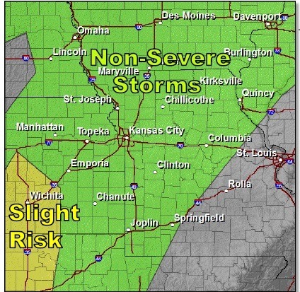
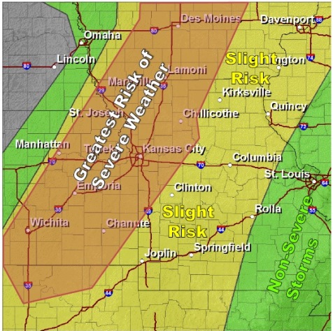
According to the National Weather Service, some of the storms could become severe on Thursday. Hail and damaging winds will be the primary threats, with a very small risk of a tornado and localized flooding on Thursday.
Scattered thunderstorms are likely throughout Thursday morning. The storms have a low probability of being severe. Strong to severe thunderstorms may redevelop later in the afternoon over eastern Kansas along a cold front that will advance east through Missouri, the weather service said.
Depending how well the atmosphere recovers, or destabilizes, from the morning storms will determine the extent and strength of any severe storms.
The severe risk will likely diminish during the evening hours. At this time, the main hazards appear to be large hail and damaging winds.