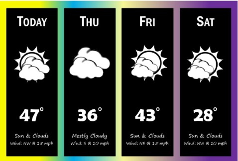
Today’s forecast is cold and windy this morning, and warming up to a high of 48 later today, according to the National Weather Service.
To the northeast of the Kansas City area, light snow is falling in parts of Missouri, according to the weather service, and may continue through the afternoon.
Snow is not in the Wyandotte County forecast, however.
A south wind today of 10 to 15 will gust to 21 mph and will become light and variable in the afternoon, according to the weather service.
Today there is a heightened fire danger because of warm afternoon temperatures, dry air and breezy winds, the weather service said.
Tonight, the low will be around 20, with east northeast winds at 5 to 10 mph.
Thursday, expect partly sunny skies and a high of 34, the weather service said. Thursday night, the low will be around 26.
Friday, the high temperature will be near 41, the weather service said, with mostly sunny skies. A light wind will become north 8 to 13 mph in the afternoon. Friday night’s low will be around 14.
Saturday, expect partly sunny skies and a high of 27, according to the weather service. Saturday night’s low will be 21.
On Sunday, there is a 40 percent chance of rain and snow, the weather service said, with a high near 39. The potential for snow is still uncertain, according to the weather service.